
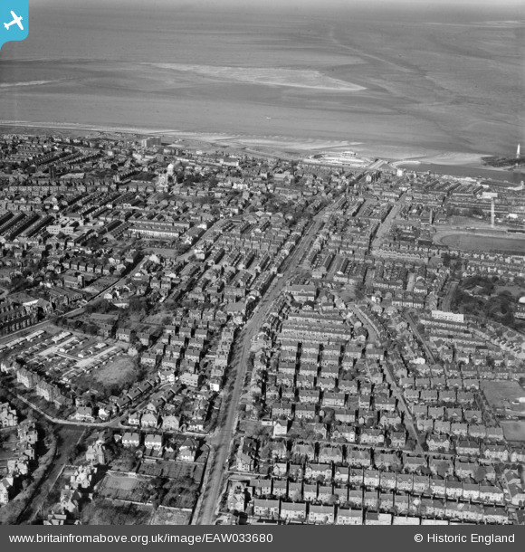
EAW033680 ENGLAND (1950). Seabank Road and environs, New Brighton, 1950
© Copyright OpenStreetMap contributors and licensed by the OpenStreetMap Foundation. 2026. Cartography is licensed as CC BY-SA.
Nearby Images (2)
EAW033680

EAW001797

Details
| Title | [EAW033680] Seabank Road and environs, New Brighton, 1950 |
| Reference | EAW033680 |
| Date | 16-October-1950 |
| Link | |
| Place name | NEW BRIGHTON |
| Parish | |
| District | |
| Country | ENGLAND |
| Easting / Northing | 330939, 393365 |
| Longitude / Latitude | -3.0395946217026, 53.432282780579 |
| National Grid Reference | SJ309934 |
Pins

Saul Marks |
Tuesday 26th of May 2026 01:28:21 AM | |
|
Saul Marks |
Tuesday 26th of May 2026 01:26:59 AM | |
|
Saul Marks |
Tuesday 26th of May 2026 01:26:36 AM | |
|
Ian Sheppard |
Saturday 3rd of February 2024 08:33:24 PM | |
|
redmist |
Thursday 10th of October 2019 01:13:43 PM | |
|
gBr |
Sunday 3rd of August 2014 05:53:46 PM |