
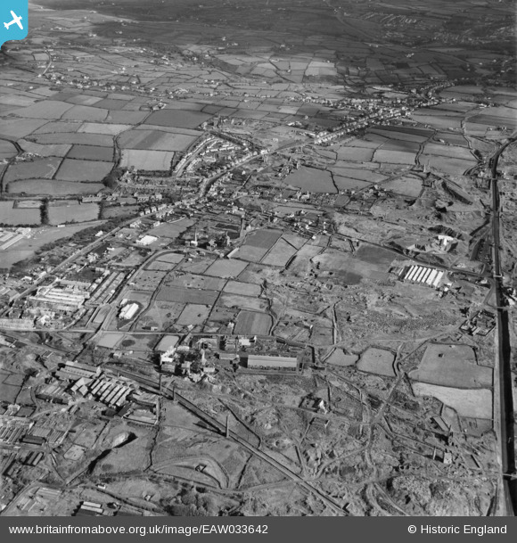
EAW033642 ENGLAND (1950). South Crofty Tin Mine and environs, Brae, from the south-west, 1950
© Copyright OpenStreetMap contributors and licensed by the OpenStreetMap Foundation. 2026. Cartography is licensed as CC BY-SA.
Nearby Images (6)
EAW033642

EPW009938

EPW059588

EAW033644

EPW009935

EAW033643

Details
| Title | [EAW033642] South Crofty Tin Mine and environs, Brae, from the south-west, 1950 |
| Reference | EAW033642 |
| Date | 12-October-1950 |
| Link | |
| Place name | BREA |
| Parish | CARN BREA |
| District | |
| Country | ENGLAND |
| Easting / Northing | 166507, 40927 |
| Longitude / Latitude | -5.2737251560209, 50.221561002484 |
| National Grid Reference | SW665409 |
Pins
Be the first to add a comment to this image!