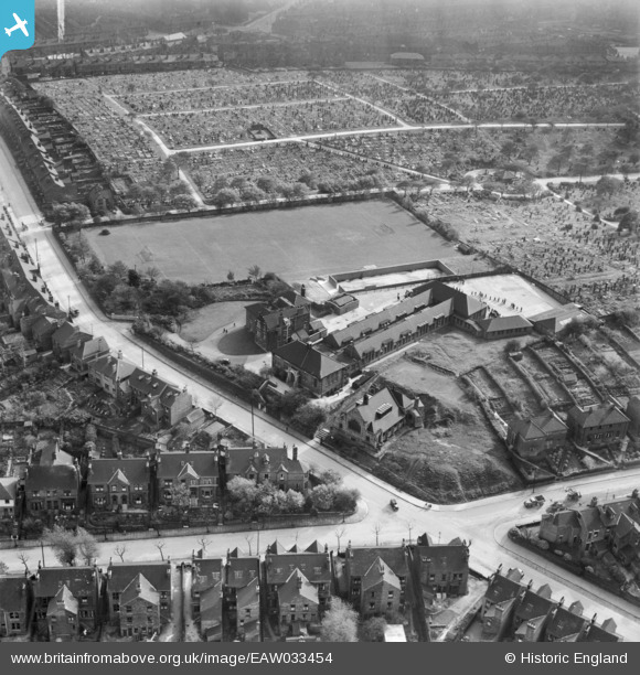
EAW033454 ENGLAND (1950). De La Salle College and Burngreave Cemetery, Pitsmoor, 1950
© Copyright OpenStreetMap contributors and licensed by the OpenStreetMap Foundation. 2026. Cartography is licensed as CC BY-SA.
Details
| Title | [EAW033454] De La Salle College and Burngreave Cemetery, Pitsmoor, 1950 |
| Reference | EAW033454 |
| Date | 12-October-1950 |
| Link | |
| Place name | PITSMOOR |
| Parish | |
| District | |
| Country | ENGLAND |
| Easting / Northing | 436097, 389550 |
| Longitude / Latitude | -1.4570230992163, 53.40127686261 |
| National Grid Reference | SK361896 |
Pins

Matt Aldred edob.mattaldred.com |
Tuesday 22nd of February 2022 09:53:44 PM | |

redmist |
Monday 14th of January 2019 11:34:34 AM | |

redmist |
Monday 14th of January 2019 11:33:13 AM |


![[EAW033454] De La Salle College and Burngreave Cemetery, Pitsmoor, 1950](http://britainfromabove.org.uk/sites/all/libraries/aerofilms-images/public/100x100/EAW/033/EAW033454.jpg)
![[EAW033453] De La Salle College and Burngreave Cemetery, Pitsmoor, 1950. This image was marked by Aerofilms Ltd for photo editing.](http://britainfromabove.org.uk/sites/all/libraries/aerofilms-images/public/100x100/EAW/033/EAW033453.jpg)
![[EAW033452] De La Salle College, Pitsmoor, 1950. This image was marked by Aerofilms Ltd for photo editing.](http://britainfromabove.org.uk/sites/all/libraries/aerofilms-images/public/100x100/EAW/033/EAW033452.jpg)
![[EAW033455] De La Salle College and Burngreave Cemetery, Pitsmoor, 1950](http://britainfromabove.org.uk/sites/all/libraries/aerofilms-images/public/100x100/EAW/033/EAW033455.jpg)