
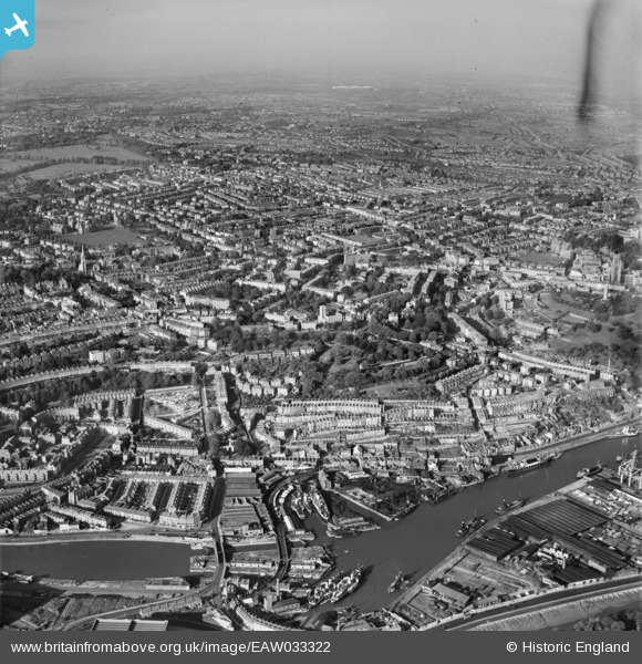
EAW033322 ENGLAND (1950). Clifton Wood and the city, Bristol, from the south, 1950
© Copyright OpenStreetMap contributors and licensed by the OpenStreetMap Foundation. 2026. Cartography is licensed as CC BY-SA.
Nearby Images (6)
EAW033322

EAW033319

EPW012231
, the Floating Harbour and Hotwells, Bristol, 1924. This image has been produced from a copy-negative.")
EPW033499

EAW033316
 moored off Hotwell Road, Bristol, 1950")
EAW002050

Details
| Title | [EAW033322] Clifton Wood and the city, Bristol, from the south, 1950 |
| Reference | EAW033322 |
| Date | 5-October-1950 |
| Link | |
| Place name | BRISTOL |
| Parish | |
| District | |
| Country | ENGLAND |
| Easting / Northing | 357296, 172540 |
| Longitude / Latitude | -2.6146044219607, 51.449743905714 |
| National Grid Reference | ST573725 |
Pins

Hew |
Saturday 12th of February 2022 12:39:21 PM | |
|
Hew |
Saturday 12th of February 2022 12:39:03 PM | |
|
Geoff |
Tuesday 5th of August 2014 01:40:40 PM | |
|
Geoff |
Tuesday 5th of August 2014 01:39:08 PM | |
|
Geoff |
Tuesday 5th of August 2014 01:38:26 PM | |
|
Geoff |
Tuesday 5th of August 2014 01:37:23 PM | |
|
Geoff |
Tuesday 5th of August 2014 01:35:02 PM | |
|
Geoff |
Tuesday 5th of August 2014 01:33:04 PM |