
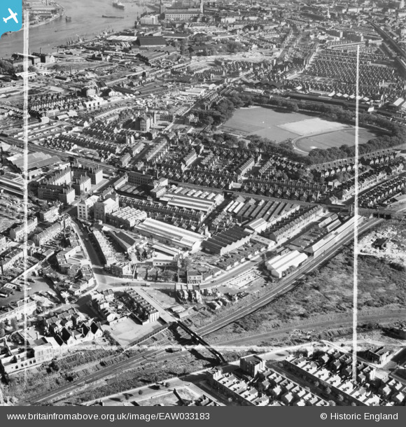
EAW033183 ENGLAND (1950). The Molins Machine Co Works, Deptford Park and the surrounding area, Deptford, 1950. This image was marked by Aerofilms Ltd for photo editing.
© Copyright OpenStreetMap contributors and licensed by the OpenStreetMap Foundation. 2026. Cartography is licensed as CC BY-SA.
Nearby Images (17)
EAW033183

EAW033186

EAW033189

EAW033190

EAW033187

EAW033241

EAW033188

EAW033185

EAW033181

EAW033236

EAW033182

EAW033242

EAW033184

EAW033239

EAW033238

EAW033237

EAW033240

Details
| Title | [EAW033183] The Molins Machine Co Works, Deptford Park and the surrounding area, Deptford, 1950. This image was marked by Aerofilms Ltd for photo editing. |
| Reference | EAW033183 |
| Date | 5-October-1950 |
| Link | |
| Place name | DEPTFORD |
| Parish | |
| District | |
| Country | ENGLAND |
| Easting / Northing | 535999, 178455 |
| Longitude / Latitude | -0.040953004728175, 51.4881827999 |
| National Grid Reference | TQ360785 |
