
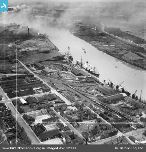
EAW032388 ENGLAND (1950). Dent's Wharf, Middlesbrough, 1950. This image was marked by Aerofilms Ltd for photo editing.
© Copyright OpenStreetMap contributors and licensed by the OpenStreetMap Foundation. 2026. Cartography is licensed as CC BY-SA.
Nearby Images (11)
EAW032388

EAW032391

EAW032396

EAW032387

EAW032393

EAW032397

EAW032389

EAW032392

EAW032395

EAW032394

EAW032390

Details
| Title | [EAW032388] Dent's Wharf, Middlesbrough, 1950. This image was marked by Aerofilms Ltd for photo editing. |
| Reference | EAW032388 |
| Date | 4-September-1950 |
| Link | |
| Place name | MIDDLESBROUGH |
| Parish | |
| District | |
| Country | ENGLAND |
| Easting / Northing | 449378, 521430 |
| Longitude / Latitude | -1.2358636613135, 54.585531490804 |
| National Grid Reference | NZ494214 |
Pins

morbidthepoet |
Saturday 24th of February 2024 12:30:17 PM | |
|
morbidthepoet |
Wednesday 7th of February 2024 05:31:38 PM | |
|
morbidthepoet |
Wednesday 7th of February 2024 05:30:28 PM |