
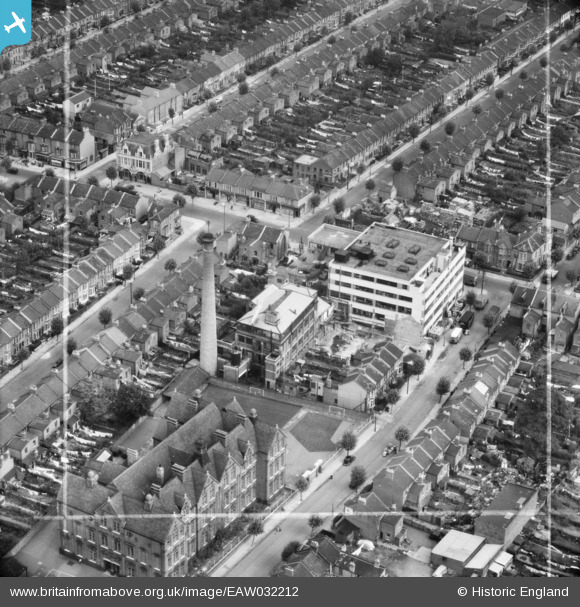
EAW032212 ENGLAND (1950). The Trebor Factory and surrounding terraced housing, Upton, 1950. This image was marked by Aerofilms Ltd for photo editing.
© Copyright OpenStreetMap contributors and licensed by the OpenStreetMap Foundation. 2026. Cartography is licensed as CC BY-SA.
Nearby Images (8)
EAW032212

EAW032211

EAW032205

EAW032210

EAW032209

EAW032206

EAW032207

EAW032208

Details
| Title | [EAW032212] The Trebor Factory and surrounding terraced housing, Upton, 1950. This image was marked by Aerofilms Ltd for photo editing. |
| Reference | EAW032212 |
| Date | 4-September-1950 |
| Link | |
| Place name | UPTON |
| Parish | |
| District | |
| Country | ENGLAND |
| Easting / Northing | 541435, 184367 |
| Longitude / Latitude | 0.039671993526228, 51.539979017504 |
| National Grid Reference | TQ414844 |
Pins

Hermann the German |
Tuesday 10th of October 2017 03:20:04 PM |