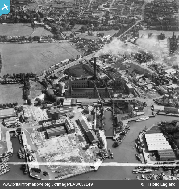
EAW032149 ENGLAND (1950). The Power Station on Gunwharf Road, Camber Dock and environs, Portsmouth, 1950. This image was marked by Aerofilms Ltd for photo editing.
© Copyright OpenStreetMap contributors and licensed by the OpenStreetMap Foundation. 2026. Cartography is licensed as CC BY-SA.
Nearby Images (35)
EAW032149

EAW034583

EAW034582

EAW037859

EAW034581

EAW037860

EAW037863

EAW032154

EAW037857

EAW032156

EAW037858

EAW032151

EAW037862

EAW034584

EAW034585

EAW032157

EAW037861
 off Gunwharf Road, Old Portsmouth, 1951. This image has been produced from a damaged negative.")
EAW032153

EAW032150

EAW037856
 off Gunwharf Road, Old Portsmouth, 1951. This image has been produced from a damaged negative.")
EAW032147

EAW034587

EAW032152

EAW037853

EAW032155

EAW034586

EAW034592

EAW032148

EAW034591

EAW034590

EAW037854

EAW034588

EAW034589

EAW037855
 off Gunwharf Road, Old Portsmouth, 1951. This image has been produced from a damaged negative.")
EAW037852
 off Gunwharf Road, Old Portsmouth, 1951. This image has been produced from a damaged negative.")
Details
| Title | [EAW032149] The Power Station on Gunwharf Road, Camber Dock and environs, Portsmouth, 1950. This image was marked by Aerofilms Ltd for photo editing. |
| Reference | EAW032149 |
| Date | 1-September-1950 |
| Link | |
| Place name | PORTSMOUTH |
| Parish | |
| District | |
| Country | ENGLAND |
| Easting / Northing | 463229, 99683 |
| Longitude / Latitude | -1.1028101020437, 50.792695405077 |
| National Grid Reference | SZ632997 |
Pins

redmist |
Friday 10th of July 2020 11:26:00 AM | |
|
redmist |
Friday 10th of July 2020 11:24:39 AM | |
|
John Wass |
Tuesday 1st of November 2016 02:55:03 PM | |

Class31 |
Friday 17th of October 2014 06:02:44 PM | |
|
Class31 |
Thursday 16th of October 2014 11:09:31 PM | |
|
Class31 |
Thursday 16th of October 2014 11:04:18 PM | |
|
Class31 |
Thursday 16th of October 2014 08:51:26 PM | |
|
Class31 |
Thursday 16th of October 2014 08:51:05 PM | |
|
Class31 |
Thursday 16th of October 2014 08:50:46 PM | |
|
Class31 |
Thursday 16th of October 2014 08:50:19 PM |