
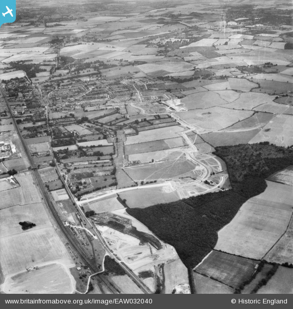
EAW032040 ENGLAND (1950). The Monkswood Estate in the early stages of construction and environs, Stevenage, 1950
© Copyright OpenStreetMap contributors and licensed by the OpenStreetMap Foundation. 2026. Cartography is licensed as CC BY-SA.
Nearby Images (2)
EAW032040

EAW032037

Details
| Title | [EAW032040] The Monkswood Estate in the early stages of construction and environs, Stevenage, 1950 |
| Reference | EAW032040 |
| Date | 23-August-1950 |
| Link | |
| Place name | STEVENAGE |
| Parish | |
| District | |
| Country | ENGLAND |
| Easting / Northing | 524175, 223932 |
| Longitude / Latitude | -0.19499023568022, 51.899640832239 |
| National Grid Reference | TL242239 |
Pins

Howie |
Sunday 18th of April 2021 04:44:22 AM | |
|
paulinuk |
Saturday 16th of November 2019 09:41:23 PM | |
|
andy |
Monday 22nd of July 2019 04:43:23 PM | |
|
Howie |
Wednesday 15th of April 2015 04:19:47 AM | |
|
Howie |
Wednesday 15th of April 2015 04:13:39 AM | |
|
Howie |
Wednesday 15th of April 2015 04:11:53 AM | |
|
Howie |
Wednesday 15th of April 2015 04:04:44 AM | |
|
Howie |
Wednesday 15th of April 2015 03:59:58 AM | |
|
Howie |
Wednesday 15th of April 2015 03:58:46 AM | |
|
Howie |
Wednesday 15th of April 2015 03:57:17 AM | |
|
Howie |
Wednesday 15th of April 2015 03:55:53 AM | |
|
Howie |
Wednesday 15th of April 2015 03:51:43 AM | |
|
Howie |
Wednesday 15th of April 2015 03:49:42 AM |