
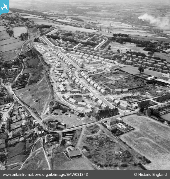
EAW031343 ENGLAND (1950). New houses along Edge Avenue, Thornhill Edge, 1950
© Copyright OpenStreetMap contributors and licensed by the OpenStreetMap Foundation. 2026. Cartography is licensed as CC BY-SA.
Nearby Images (7)
EAW031343

EAW031350

EAW031346

EAW031347

EAW031349

EAW031348

EAW031351

Details
| Title | [EAW031343] New houses along Edge Avenue, Thornhill Edge, 1950 |
| Reference | EAW031343 |
| Date | 26-July-1950 |
| Link | |
| Place name | THORNHILL EDGE |
| Parish | |
| District | |
| Country | ENGLAND |
| Easting / Northing | 425030, 418223 |
| Longitude / Latitude | -1.6211967647678, 53.65966565495 |
| National Grid Reference | SE250182 |
Pins

HOLMES |
Monday 18th of May 2020 08:52:38 PM |