
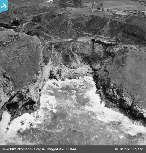
EAW031044 ENGLAND (1950). Merlin's Cave and the remains of Tintagel Castle, Tintagel, 1950
© Copyright OpenStreetMap contributors and licensed by the OpenStreetMap Foundation. 2026. Cartography is licensed as CC BY-SA.
Nearby Images (14)
EAW031044

EAW031019

EAW005829

EAW005831

EAW005828

EAW005833

EAW031042

EAW031045

EAW005832

EAW031015

EAW031043

EAW005830

EAW031046

EAW031013

Details
| Title | [EAW031044] Merlin's Cave and the remains of Tintagel Castle, Tintagel, 1950 |
| Reference | EAW031044 |
| Date | 11-July-1950 |
| Link | |
| Place name | TINTAGEL |
| Parish | TINTAGEL |
| District | |
| Country | ENGLAND |
| Easting / Northing | 205099, 88953 |
| Longitude / Latitude | -4.7583491905525, 50.666995847371 |
| National Grid Reference | SX051890 |
Pins
Be the first to add a comment to this image!