
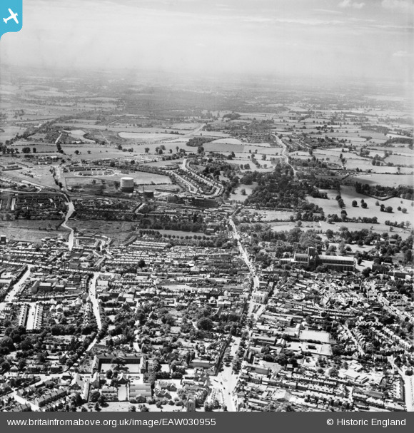
EAW030955 ENGLAND (1950). The city centre, St Albans, from the north-east, 1950
© Copyright OpenStreetMap contributors and licensed by the OpenStreetMap Foundation. 2026. Cartography is licensed as CC BY-SA.
Nearby Images (20)
EAW030955

EPW025393

EAW000662

EPW025386

EAW015583A

EPW047110

EPW017814

EPW019241

EAW030954

EPW017813

EPW001255

EPW047111

EPW005304

EPW047106

EPW047108

EAW015584

EAW048027

EPW047109

EPW047112

EPW047107

Details
| Title | [EAW030955] The city centre, St Albans, from the north-east, 1950 |
| Reference | EAW030955 |
| Date | 13-July-1950 |
| Link | |
| Place name | ST ALBANS |
| Parish | |
| District | |
| Country | ENGLAND |
| Easting / Northing | 514777, 206957 |
| Longitude / Latitude | -0.33716342292954, 51.74908152015 |
| National Grid Reference | TL148070 |
Pins

John W |
Monday 3rd of October 2016 03:30:04 PM |