
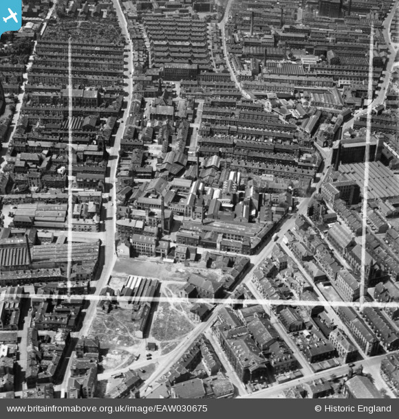
EAW030675 ENGLAND (1950). Gibbet Street and Keighley Mill, Halifax, 1950. This image was marked by Aerofilms Ltd for photo editing.
© Copyright OpenStreetMap contributors and licensed by the OpenStreetMap Foundation. 2026. Cartography is licensed as CC BY-SA.
Nearby Images (17)
EAW030675

EAW030680

EAW030674

EAW030681

EAW030677

EAW030679

EAW030673

EAW030678

EAW030676

EAW028053

EPW036849

EPW036846

EAW028056

EPW024494

EAW028059

EPW024491

EAW028058

Details
| Title | [EAW030675] Gibbet Street and Keighley Mill, Halifax, 1950. This image was marked by Aerofilms Ltd for photo editing. |
| Reference | EAW030675 |
| Date | June-1950 |
| Link | |
| Place name | HALIFAX |
| Parish | |
| District | |
| Country | ENGLAND |
| Easting / Northing | 408881, 425324 |
| Longitude / Latitude | -1.8653903509528, 53.724021290687 |
| National Grid Reference | SE089253 |
Pins
Be the first to add a comment to this image!