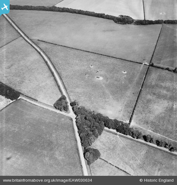
EAW030634 ENGLAND (1950). Hunsley Four Lane Ends, High Hunsley, 1950
© Copyright OpenStreetMap contributors and licensed by the OpenStreetMap Foundation. 2025. Cartography is licensed as CC BY-SA.
Nearby Images (8)
Details
| Title | [EAW030634] Hunsley Four Lane Ends, High Hunsley, 1950 |
| Reference | EAW030634 |
| Date | 29-June-1950 |
| Link | |
| Place name | HIGH HUNSLEY |
| Parish | ROWLEY |
| District | |
| Country | ENGLAND |
| Easting / Northing | 494763, 435225 |
| Longitude / Latitude | -0.56088050981236, 53.804463587431 |
| National Grid Reference | SE948352 |
Pins
Be the first to add a comment to this image!


![[EAW030634] Hunsley Four Lane Ends, High Hunsley, 1950](http://britainfromabove.org.uk/sites/all/libraries/aerofilms-images/public/100x100/EAW/030/EAW030634.jpg)
![[EAW030621] Hunsley Four Lane Ends, High Hunsley, 1950](http://britainfromabove.org.uk/sites/all/libraries/aerofilms-images/public/100x100/EAW/030/EAW030621.jpg)
![[EAW030635] Hunsley Four Lane Ends, High Hunsley, 1950](http://britainfromabove.org.uk/sites/all/libraries/aerofilms-images/public/100x100/EAW/030/EAW030635.jpg)
![[EAW030627] Hunsley Four Lane Ends, High Hunsley, 1950](http://britainfromabove.org.uk/sites/all/libraries/aerofilms-images/public/100x100/EAW/030/EAW030627.jpg)
![[EAW030632] Horses grazing near Pasture Plantation, High Hunsley, 1950](http://britainfromabove.org.uk/sites/all/libraries/aerofilms-images/public/100x100/EAW/030/EAW030632.jpg)
![[EAW030629] Hunsley House, High Hunsley, 1950](http://britainfromabove.org.uk/sites/all/libraries/aerofilms-images/public/100x100/EAW/030/EAW030629.jpg)
![[EAW030631] Hunsley Four Lane Ends, High Hunsley, 1950](http://britainfromabove.org.uk/sites/all/libraries/aerofilms-images/public/100x100/EAW/030/EAW030631.jpg)
![[EAW030617] Hunsley House, High Hunsley, 1950](http://britainfromabove.org.uk/sites/all/libraries/aerofilms-images/public/100x100/EAW/030/EAW030617.jpg)