
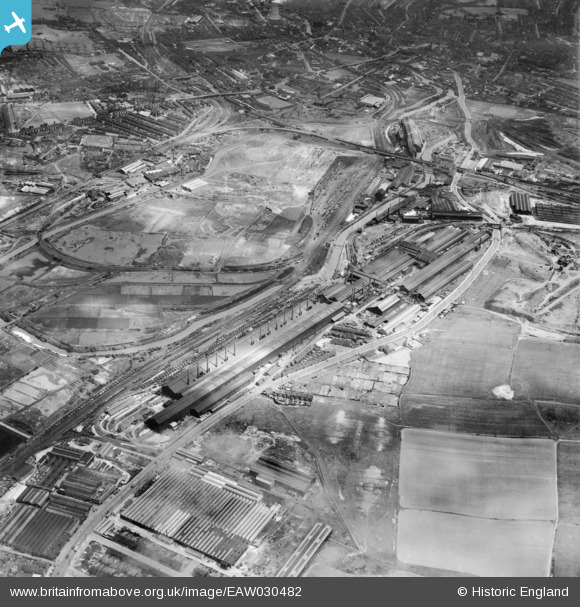
EAW030482 ENGLAND (1950). The Steel, Peech and Tozer Templeborough Steel Works and environs, Templeborough, 1950
© Copyright OpenStreetMap contributors and licensed by the OpenStreetMap Foundation. 2026. Cartography is licensed as CC BY-SA.
Nearby Images (16)
EAW030482

EAW030480

EPW041707

EAW030481

EPW041702

EPW041706

EAW030493

EAW030484

EPW015447

EAW030483

EPW041704

EPW048724

EAW030491

EPW041701

EAW025973

EAW030490

Details
| Title | [EAW030482] The Steel, Peech and Tozer Templeborough Steel Works and environs, Templeborough, 1950 |
| Reference | EAW030482 |
| Date | 23-June-1950 |
| Link | |
| Place name | TEMPLEBOROUGH |
| Parish | |
| District | |
| Country | ENGLAND |
| Easting / Northing | 441029, 391697 |
| Longitude / Latitude | -1.3825601639471, 53.420216045416 |
| National Grid Reference | SK410917 |
Pins
Be the first to add a comment to this image!