
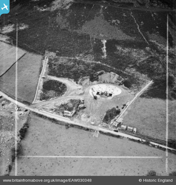
EAW030348 ENGLAND (1950). A covered reservoir under construction on the slopes of The Cloud, Timbersbrook, 1950. This image was marked by Aerofilms Ltd for photo editing.
© Copyright OpenStreetMap contributors and licensed by the OpenStreetMap Foundation. 2025. Cartography is licensed as CC BY-SA.
Nearby Images (6)
EAW030348

EAW030350

EAW030352

EAW030349

EAW030347

EAW030351

Details
| Title | [EAW030348] A covered reservoir under construction on the slopes of The Cloud, Timbersbrook, 1950. This image was marked by Aerofilms Ltd for photo editing. |
| Reference | EAW030348 |
| Date | 15-June-1950 |
| Link | |
| Place name | TIMBERSBROOK |
| Parish | CONGLETON |
| District | |
| Country | ENGLAND |
| Easting / Northing | 390389, 363911 |
| Longitude / Latitude | -2.1437975787775, 53.171935476034 |
| National Grid Reference | SJ904639 |
Pins
Be the first to add a comment to this image!