
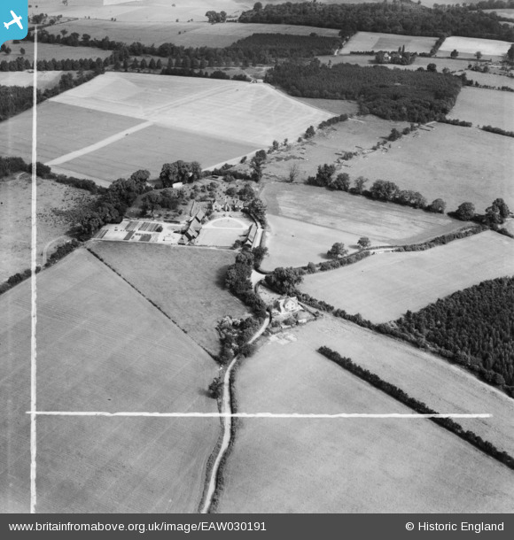
EAW030191 ENGLAND (1950). Bride Hall and the surrounding countryside, Wheathampstead, 1950. This image was marked by Aerofilms Ltd for photo editing.
© Copyright OpenStreetMap contributors and licensed by the OpenStreetMap Foundation. 2026. Cartography is licensed as CC BY-SA.
Nearby Images (8)
EAW030191

EAW030192

EAW030193

EAW030189

EAW030187

EAW030186

EAW030188

EAW030190

Details
| Title | [EAW030191] Bride Hall and the surrounding countryside, Wheathampstead, 1950. This image was marked by Aerofilms Ltd for photo editing. |
| Reference | EAW030191 |
| Date | 13-June-1950 |
| Link | |
| Place name | WHEATHAMPSTEAD |
| Parish | WHEATHAMPSTEAD |
| District | |
| Country | ENGLAND |
| Easting / Northing | 519119, 215870 |
| Longitude / Latitude | -0.27122804320469, 51.828284802607 |
| National Grid Reference | TL191159 |
Pins
Be the first to add a comment to this image!