
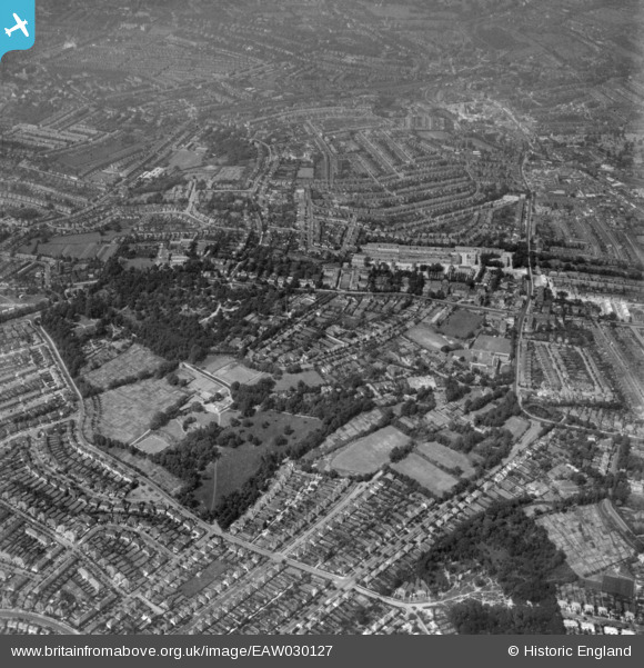
EAW030127 ENGLAND (1950). Norwood Grove, Ryecroft Road and environs, Norbury, 1950. This image has been produced from a print.
© Copyright OpenStreetMap contributors and licensed by the OpenStreetMap Foundation. 2026. Cartography is licensed as CC BY-SA.
Nearby Images (2)
EAW030127

EPW052525

Details
| Title | [EAW030127] Norwood Grove, Ryecroft Road and environs, Norbury, 1950. This image has been produced from a print. |
| Reference | EAW030127 |
| Date | 6-June-1950 |
| Link | |
| Place name | NORBURY |
| Parish | |
| District | |
| Country | ENGLAND |
| Easting / Northing | 531393, 170932 |
| Longitude / Latitude | -0.11005740034905, 51.421657752517 |
| National Grid Reference | TQ314709 |
Pins

brianbeckett |
Saturday 23rd of May 2020 06:38:50 PM | |
|
Jez |
Saturday 27th of October 2018 10:27:04 PM | |
|
brianbeckett |
Wednesday 24th of September 2014 02:54:39 PM | |
|
brianbeckett |
Wednesday 24th of September 2014 02:53:48 PM | |
|
brianbeckett |
Wednesday 24th of September 2014 02:51:56 PM | |
|
brianbeckett |
Wednesday 24th of September 2014 02:51:08 PM |