
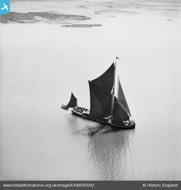
EAW030092 ENGLAND (1950). A Thames barge sailing in the River Medway, Burntwick Island, 1950
© Copyright OpenStreetMap contributors and licensed by the OpenStreetMap Foundation. 2026. Cartography is licensed as CC BY-SA.
Nearby Images (2)
EAW030092

EAW030091

Details
| Title | [EAW030092] A Thames barge sailing in the River Medway, Burntwick Island, 1950 |
| Reference | EAW030092 |
| Date | 5-June-1950 |
| Link | |
| Place name | BURNTWICK ISLAND |
| Parish | UPCHURCH |
| District | |
| Country | ENGLAND |
| Easting / Northing | 584548, 172229 |
| Longitude / Latitude | 0.6544389726264, 51.418496837986 |
| National Grid Reference | TQ845722 |
Pins

Dave Brunt |
Tuesday 6th of May 2014 12:58:25 AM | |
Thanks for spending time on this and it's pair EPW030091, we'll update the catalogue and post your new location data here in due course. Yours, Katy Britain from Above Cataloguing Team Leader |
Katy Whitaker |
Friday 27th of June 2014 04:19:52 PM |
|
Dave Brunt |
Tuesday 6th of May 2014 12:56:49 AM | |
|
Scapa |
Friday 25th of April 2014 08:21:19 PM | |
Proper name of builder more likely to be J.G. Fay & Co., Northam, Southampton. Later became part of Camper & Nicholsons. Better known as yacht builders. Site later known as Shamrock Quay. |
Peggy Bawn |
Thursday 1st of May 2014 09:47:37 AM |
|
Scapa |
Friday 25th of April 2014 07:48:33 PM |
User Comment Contributions
Spritsail Thames barge, low islands and/or mud/sand banks - must be Thames Estuary (as far out as Isle of Thanet or Blackwater Estuary. |
SheldonC |
Tuesday 10th of June 2014 10:34:01 PM |
Everything is consistent with the location given by Dave Brunt which is looking south east towards Burntwick Island from above Kethole Reach on the River Medway. |

Class31 |
Tuesday 6th of May 2014 08:25:58 AM |