
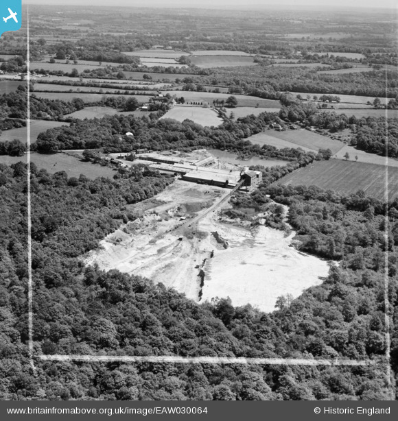
EAW030064 ENGLAND (1950). Smokejack Brickworks, Walliswood, from the west, 1950. This image was marked by Aerofilms Ltd for photo editing.
© Copyright OpenStreetMap contributors and licensed by the OpenStreetMap Foundation. 2026. Cartography is licensed as CC BY-SA.
Nearby Images (11)
EAW030064

EAW030069

EAW030066

EAW030068

EAW030071

EAW030063

EAW030067

EAW030070

EAW030072

EAW030065

EAW030073

Details
| Title | [EAW030064] Smokejack Brickworks, Walliswood, from the west, 1950. This image was marked by Aerofilms Ltd for photo editing. |
| Reference | EAW030064 |
| Date | 1-June-1950 |
| Link | |
| Place name | WALLISWOOD |
| Parish | ABINGER |
| District | |
| Country | ENGLAND |
| Easting / Northing | 511400, 137164 |
| Longitude / Latitude | -0.40803061528119, 51.122388259858 |
| National Grid Reference | TQ114372 |
Pins

Dan Gregory |
Sunday 22nd of January 2017 11:47:16 AM | |
|
Dan Gregory |
Sunday 22nd of January 2017 11:45:24 AM | |
|
Dan Gregory |
Sunday 22nd of January 2017 11:41:23 AM | |
|
Dan Gregory |
Tuesday 3rd of June 2014 12:12:17 AM | |
|
Dan Gregory |
Tuesday 3rd of June 2014 12:11:00 AM | |
|
Dan Gregory |
Monday 2nd of June 2014 11:46:36 PM | |
|
Dan Gregory |
Monday 2nd of June 2014 11:45:52 PM |