
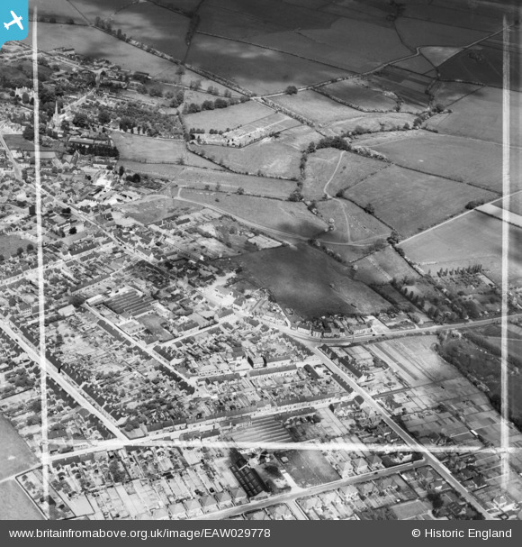
EAW029778 ENGLAND (1950). The town, Burton Latimer, 1950. This image was marked by Aerofilms Ltd for photo editing.
© Copyright OpenStreetMap contributors and licensed by the OpenStreetMap Foundation. 2026. Cartography is licensed as CC BY-SA.
Nearby Images (11)
EAW029778

EAW029781

EAW029775

EAW029776

EAW029786

EAW029784

EAW029783

EAW029773

EAW029777

EAW029782

EAW029780

Details
| Title | [EAW029778] The town, Burton Latimer, 1950. This image was marked by Aerofilms Ltd for photo editing. |
| Reference | EAW029778 |
| Date | 31-May-1950 |
| Link | |
| Place name | BURTON LATIMER |
| Parish | BURTON LATIMER |
| District | |
| Country | ENGLAND |
| Easting / Northing | 490186, 274547 |
| Longitude / Latitude | -0.67546134733278, 52.361166635373 |
| National Grid Reference | SP902745 |
Pins
Be the first to add a comment to this image!