
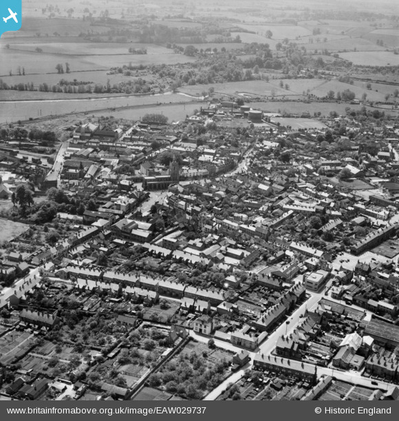
EAW029737 ENGLAND (1950). The town, Sudbury, from the north, 1950
© Copyright OpenStreetMap contributors and licensed by the OpenStreetMap Foundation. 2026. Cartography is licensed as CC BY-SA.
Nearby Images (4)
EAW029737

EAW042075

EAW042076

EAW042080

Details
| Title | [EAW029737] The town, Sudbury, from the north, 1950 |
| Reference | EAW029737 |
| Date | 30-May-1950 |
| Link | |
| Place name | SUDBURY |
| Parish | SUDBURY |
| District | |
| Country | ENGLAND |
| Easting / Northing | 587463, 241583 |
| Longitude / Latitude | 0.7336652518677, 52.040481645021 |
| National Grid Reference | TL875416 |
Pins

Matt Aldred edob.mattaldred.com |
Tuesday 7th of January 2020 01:43:54 PM | |
|
Matt Aldred edob.mattaldred.com |
Tuesday 7th of January 2020 01:42:25 PM | |
|
Matt Aldred edob.mattaldred.com |
Tuesday 7th of January 2020 01:41:56 PM | |
|
Matt Aldred edob.mattaldred.com |
Tuesday 7th of January 2020 01:40:14 PM |