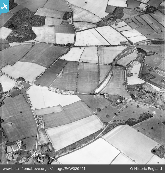
EAW029421 ENGLAND (1950). Countryside around Hempland Lane and Fawley Farm, Privett, 1950
© Copyright OpenStreetMap contributors and licensed by the OpenStreetMap Foundation. 2025. Cartography is licensed as CC BY-SA.
Details
| Title | [EAW029421] Countryside around Hempland Lane and Fawley Farm, Privett, 1950 |
| Reference | EAW029421 |
| Date | 12-May-1950 |
| Link | |
| Place name | PRIVETT |
| Parish | FROXFIELD |
| District | |
| Country | ENGLAND |
| Easting / Northing | 467328, 127782 |
| Longitude / Latitude | -1.0394673175201, 51.044903890446 |
| National Grid Reference | SU673278 |
Pins

totoro |
Sunday 18th of May 2014 09:58:22 PM | |

totoro |
Sunday 18th of May 2014 09:57:03 PM | |

totoro |
Sunday 18th of May 2014 09:55:57 PM | |

totoro |
Sunday 18th of May 2014 09:55:11 PM | |

totoro |
Sunday 18th of May 2014 09:47:30 PM | |

totoro |
Sunday 18th of May 2014 09:46:04 PM |


![[EAW029421] Countryside around Hempland Lane and Fawley Farm, Privett, 1950](http://britainfromabove.org.uk/sites/all/libraries/aerofilms-images/public/100x100/EAW/029/EAW029421.jpg)
![[EAW029420] Countryside to the north of Privett, Bailey Green, 1950](http://britainfromabove.org.uk/sites/all/libraries/aerofilms-images/public/100x100/EAW/029/EAW029420.jpg)
![[EAW029423] Countryside around Bagmore Copse, Broom Farm and Fawley Farm, Privett, 1950](http://britainfromabove.org.uk/sites/all/libraries/aerofilms-images/public/100x100/EAW/029/EAW029423.jpg)