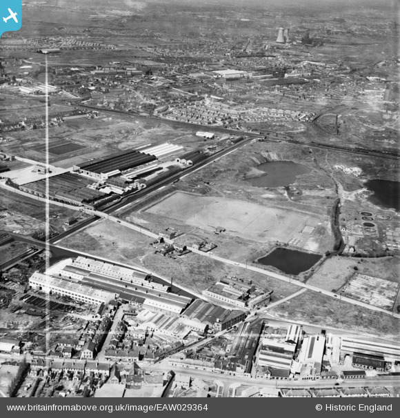
EAW029364 ENGLAND (1950). Sports Ground off Tipton Road and environs, Dudley Port, 1950. This image was marked by Aerofilms Ltd for photo editing.
© Copyright OpenStreetMap contributors and licensed by the OpenStreetMap Foundation. 2026. Cartography is licensed as CC BY-SA.
Details
| Title | [EAW029364] Sports Ground off Tipton Road and environs, Dudley Port, 1950. This image was marked by Aerofilms Ltd for photo editing. |
| Reference | EAW029364 |
| Date | 10-May-1950 |
| Link | |
| Place name | DUDLEY PORT |
| Parish | |
| District | |
| Country | ENGLAND |
| Easting / Northing | 397034, 291176 |
| Longitude / Latitude | -2.043714932689, 52.518093607986 |
| National Grid Reference | SO970912 |
Pins

jeevan |
Friday 4th of December 2020 09:07:26 AM | |

ej2095 |
Friday 19th of August 2016 09:28:19 PM | |

ej2095 |
Friday 19th of August 2016 09:27:05 PM | |

ej2095 |
Friday 19th of August 2016 09:26:27 PM | |

ej2095 |
Friday 19th of August 2016 09:25:32 PM | |

ej2095 |
Friday 19th of August 2016 09:24:56 PM | |

bolstridge.info |
Saturday 27th of February 2016 12:41:23 AM | |

stevep1855 |
Wednesday 19th of November 2014 08:59:25 AM | |

DaveT |
Tuesday 18th of March 2014 02:00:51 PM | |

DaveT |
Tuesday 18th of March 2014 01:59:12 PM | |

Toby Clempson |
Sunday 2nd of March 2014 07:13:49 AM | |
The canal being crossed is the northern approach to Netherton Canal tunnel - entrance is just off the left of the photo. |

John W |
Wednesday 20th of July 2016 06:14:39 PM |
User Comment Contributions
The title of this slide is incorrect... it is not 'The Sports Ground off Tipton Rd' |

fisha519 |
Tuesday 12th of July 2016 05:55:15 PM |


![[EAW029364] Sports Ground off Tipton Road and environs, Dudley Port, 1950. This image was marked by Aerofilms Ltd for photo editing.](http://britainfromabove.org.uk/sites/all/libraries/aerofilms-images/public/100x100/EAW/029/EAW029364.jpg)
![[EAW029359] Vono Ltd Spring Mattress Works and environs, Dudley Port, 1950. This image was marked by Aerofilms Ltd for photo editing.](http://britainfromabove.org.uk/sites/all/libraries/aerofilms-images/public/100x100/EAW/029/EAW029359.jpg)
![[EAW029363] Vono Ltd Spring Mattress Works, Dudley Port, 1950](http://britainfromabove.org.uk/sites/all/libraries/aerofilms-images/public/100x100/EAW/029/EAW029363.jpg)
![[EAW029356] Vono Ltd Spring Mattress Works and environs, Dudley Port, from the south, 1950](http://britainfromabove.org.uk/sites/all/libraries/aerofilms-images/public/100x100/EAW/029/EAW029356.jpg)