
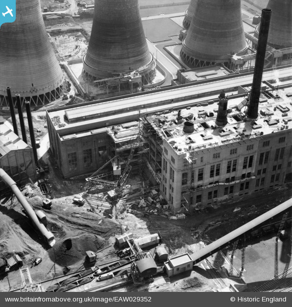
EAW029352 ENGLAND (1950). Construction work at Walsall B Power Station, Walsall, 1950
© Copyright OpenStreetMap contributors and licensed by the OpenStreetMap Foundation. 2026. Cartography is licensed as CC BY-SA.
Nearby Images (48)
EAW020822

EAW020819

EAW025505

EAW017214

EAW025525

EAW008396

EAW025504

EAW008397

EAW017221

EAW020828

EAW017216

EAW020823

EAW020827

EAW020821

EAW017220

EAW025523

EAW008393

EAW017213

EAW017212

EAW020831

EAW017215

EAW017219
, Walsall, 1948. This image has been produced from a damaged negative.")
EAW020830

EAW017218

EAW020818

EAW017211

EAW025508

EAW025517

EAW008391

EAW020832

EAW008399

EAW025507

EAW020824

EAW020815

EAW008402

EAW020826

EAW008392

EAW013443

EAW025512

EAW029330

EAW025516

EAW008400

EAW013444

EAW008398

EAW025503

EAW008401

EAW020817

EAW025515

Details
| Title | [EAW029352] Construction work at Walsall B Power Station, Walsall, 1950 |
| Reference | EAW029352 |
| Date | 10-May-1950 |
| Link | |
| Place name | WALSALL |
| Parish | |
| District | |
| Country | ENGLAND |
| Easting / Northing | 400216, 299867 |
| Longitude / Latitude | -1.9968107831083, 52.596241464036 |
| National Grid Reference | SP002999 |
Pins
Be the first to add a comment to this image!