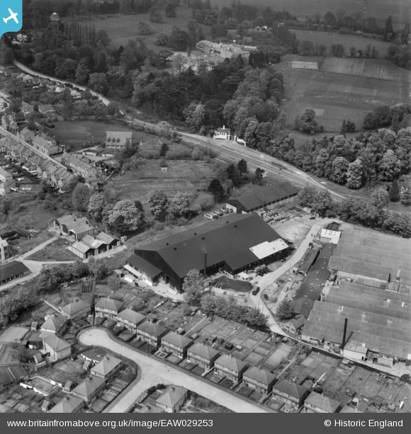
EAW029253 ENGLAND (1950). Industrial buildings at the edge of the Weybridge Trading Estate off Weybridge Road, Addlestone, 1950
© Copyright OpenStreetMap contributors and licensed by the OpenStreetMap Foundation. 2026. Cartography is licensed as CC BY-SA.
Nearby Images (5)
Details
| Title | [EAW029253] Industrial buildings at the edge of the Weybridge Trading Estate off Weybridge Road, Addlestone, 1950 |
| Reference | EAW029253 |
| Date | 9-May-1950 |
| Link | |
| Place name | ADDLESTONE |
| Parish | |
| District | |
| Country | ENGLAND |
| Easting / Northing | 506007, 164924 |
| Longitude / Latitude | -0.4768465766625, 51.372966752867 |
| National Grid Reference | TQ060649 |
Pins

Brian |
Friday 20th of September 2024 04:09:48 PM | |

The_Engineer |
Friday 24th of October 2014 05:23:31 PM | |

The_Engineer |
Friday 24th of October 2014 05:21:29 PM |


![[EAW029253] Industrial buildings at the edge of the Weybridge Trading Estate off Weybridge Road, Addlestone, 1950](http://britainfromabove.org.uk/sites/all/libraries/aerofilms-images/public/100x100/EAW/029/EAW029253.jpg)
![[EAW029252] Industrial buildings at the edge of the Weybridge Trading Estate off Weybridge Road, Addlestone, 1950. This image was marked by Aerofilms Ltd for photo editing.](http://britainfromabove.org.uk/sites/all/libraries/aerofilms-images/public/100x100/EAW/029/EAW029252.jpg)
![[EAW029251] Albert Road and the Weymann's Ltd factory on Station Road, Addlestone, from the south-east, 1950. This image was marked by Aerofilms Ltd for photo editing.](http://britainfromabove.org.uk/sites/all/libraries/aerofilms-images/public/100x100/EAW/029/EAW029251.jpg)
![[EPW001524] Black Boy Works, Hamm Moor, 1920](http://britainfromabove.org.uk/sites/all/libraries/aerofilms-images/public/100x100/EPW/001/EPW001524.jpg)
![[EPW060355] The Black Boy Works, Woburn Farm and environs, Hamm Moor, 1939](http://britainfromabove.org.uk/sites/all/libraries/aerofilms-images/public/100x100/EPW/060/EPW060355.jpg)