© Copyright OpenStreetMap contributors and licensed by the OpenStreetMap Foundation. 2026. Cartography is licensed as CC BY-SA.
Details
| Title |
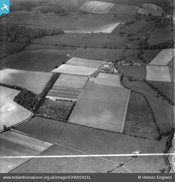
[EAW029131] Castle Farm and environs, Shoreham, 1950. This image was marked by Aerofilms Ltd for photo editing. |
| Reference |
EAW029131 |
| Date |
9-May-1950 |
| Link |
|
| Place name |
SHOREHAM |
| Parish |
SHOREHAM |
| District |
|
| Country |
ENGLAND |
| Easting / Northing |
552355, 163261 |
| Longitude / Latitude |
0.1879462541817, 51.347478176422 |
| National Grid Reference |
TQ524633 |
Pins
 WW2 Hutment |

Sparky |
Sunday 3rd of September 2017 10:43:50 PM |
Castle Farm, Shoreham TN14 7UB
The farmhouse is a Grade 2 listed building - English Heritage Building ID: 447953
Currently a mixed farm predominately arable, livestock, hops (grown on site for c 300 years) and lavender (first planting 1998) plus the very popular Hop Shop with its unusual product range and busy mail order business. Pick your own apple orchards. Owned by one family for over a century.
17th Century farmhouse embodying part of a ruined medieval castle. Left gabled section C16, right gabled section circa 1600 and link between possibly C17
Behind the poplars are the poles of a hop garden.
Shoreham Castle is a medieval fortified manorial complex, founded on lands granted to Bishop Odo of Bayeux.
In 1307 the stone castle passed to Hugo de Poyntz, who held it under the archbishop of Canterbury.
There are references of a 15th century ownership dispute and that the castle had a moat fed by the River Darenth. Sadly by the 16th century the castle was in ruins and no trace of the moat can now be found.
An irregular-shaped timber-framed 16th to 17th century farmhouse of three builds, incorporates a chunk of flint walling of exceptional thickness which narrows and curves round, from south to east.
Also surviving to the east are two massive fragments of flint walling but the extent or layout of the castle has never been resolved.
The site was the manor of Lulling stone-castle until 1715, when Percival Hart transferred the title to his manor house at Lullingstone Park. (Source www.castleuk.net/)
1940- World War Two:
on 15 September 1940, a Dornier Do 17Z, part of a force of about 100 German bombers approaching London, was shot down shortly before noon. The unfortunate pilot of the Dornier was forced to land in a field at Castle Farm, with a Spitfire circling overhead, its cockpit canopy open, and its pilot waving a handkerchief, to signal a warning to the growing crowd of hop-pickers nearby to stay away until the Shoreham Home Guard arrived to recover the German crew. Feldwebel Heitsch, was the pilot and Feldwebel Pfeiffer, the observer.
(Source wikipedia [[Shoreham, Kent]]
Castle Farm Cottages are Grade 2 listed English Heritage Building ID: 447956
largely C18 but with timber-framed core; and C19 additions and alterations.
Wall to the East of the farmhouse is separately Grade 2 listed - English Heritage Building ID: 447954
Mediaeval flint rubble retaining wall
The Garden boundary wall to the farmhouse is separately Grade 2 listed - English Heritage Building ID: 447955
C18 or early C19 red brick boundary wall surrounding garden. |

totoro |
Monday 6th of October 2014 06:11:12 PM |