
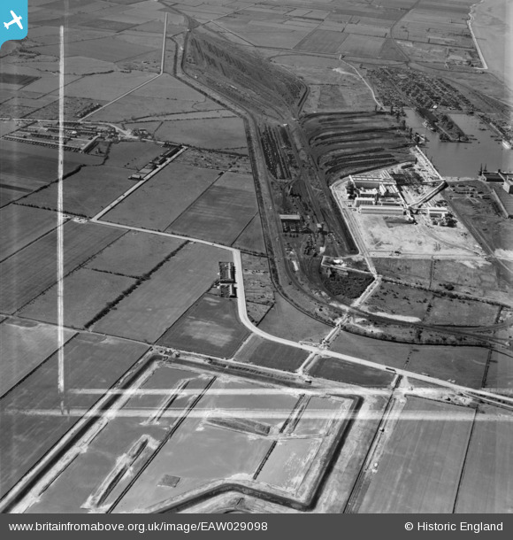
EAW029098 ENGLAND (1950). Immingham Dock, Immingham, 1950. This image was marked by Aerofilms Ltd for photo editing.
© Copyright OpenStreetMap contributors and licensed by the OpenStreetMap Foundation. 2025. Cartography is licensed as CC BY-SA.
Nearby Images (2)
EAW029098

EPW006531

Details
| Title | [EAW029098] Immingham Dock, Immingham, 1950. This image was marked by Aerofilms Ltd for photo editing. |
| Reference | EAW029098 |
| Date | 4-May-1950 |
| Link | |
| Place name | IMMINGHAM |
| Parish | IMMINGHAM |
| District | |
| Country | ENGLAND |
| Easting / Northing | 519901, 414947 |
| Longitude / Latitude | -0.18716291938078, 53.617086685322 |
| National Grid Reference | TA199149 |
Pins

redmist |
Saturday 23rd of February 2019 09:54:29 PM | |
|
redmist |
Saturday 23rd of February 2019 09:52:55 PM | |

Sparky |
Sunday 22nd of October 2017 11:23:34 PM | |

Class31 |
Monday 31st of March 2014 04:39:05 PM | |
They came in from the right, up the gradient onto the roadway. Then they reversed along that road, over the bridge towards Immingham. |
John Wass |
Friday 11th of July 2014 08:07:36 PM |