
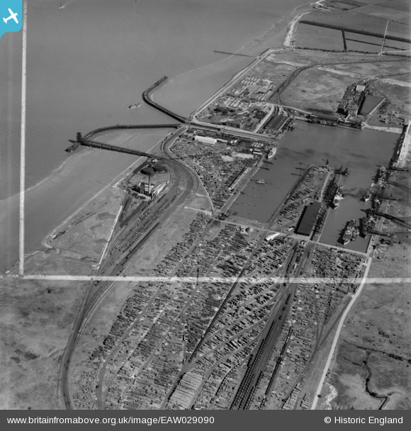
EAW029090 ENGLAND (1950). Immingham Dock, Immingham, 1950. image was marked by Aerofilms Ltd for photo editing.
© Copyright OpenStreetMap contributors and licensed by the OpenStreetMap Foundation. 2026. Cartography is licensed as CC BY-SA.
Nearby Images (2)
EAW029090

EPW031801

Details
| Title | [EAW029090] Immingham Dock, Immingham, 1950. image was marked by Aerofilms Ltd for photo editing. |
| Reference | EAW029090 |
| Date | 10-May-1950 |
| Link | |
| Place name | IMMINGHAM |
| Parish | IMMINGHAM |
| District | |
| Country | ENGLAND |
| Easting / Northing | 519384, 416507 |
| Longitude / Latitude | -0.19437706304262, 53.631221094573 |
| National Grid Reference | TA194165 |
Pins

vauqueliniere |
Thursday 26th of November 2020 11:39:25 AM | |
|
redmist |
Saturday 23rd of February 2019 10:52:35 PM | |
|
redmist |
Saturday 23rd of February 2019 10:51:22 PM | |

Class31 |
Monday 31st of March 2014 04:45:24 PM |