
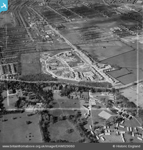
EAW029060 ENGLAND (1950). Construction of new housing around Beverley Crescent, Weelsby, 1950. This image was marked by Aerofilms Ltd for photo editing.
© Copyright OpenStreetMap contributors and licensed by the OpenStreetMap Foundation. 2026. Cartography is licensed as CC BY-SA.
Nearby Images (2)
EAW029060

EAW029055

Details
| Title | [EAW029060] Construction of new housing around Beverley Crescent, Weelsby, 1950. This image was marked by Aerofilms Ltd for photo editing. |
| Reference | EAW029060 |
| Date | 10-May-1950 |
| Link | |
| Place name | WEELSBY |
| Parish | |
| District | |
| Country | ENGLAND |
| Easting / Northing | 528262, 408136 |
| Longitude / Latitude | -0.063626089237925, 53.553914546189 |
| National Grid Reference | TA283081 |
Pins

James Chandler |
Wednesday 12th of February 2014 08:19:04 PM |