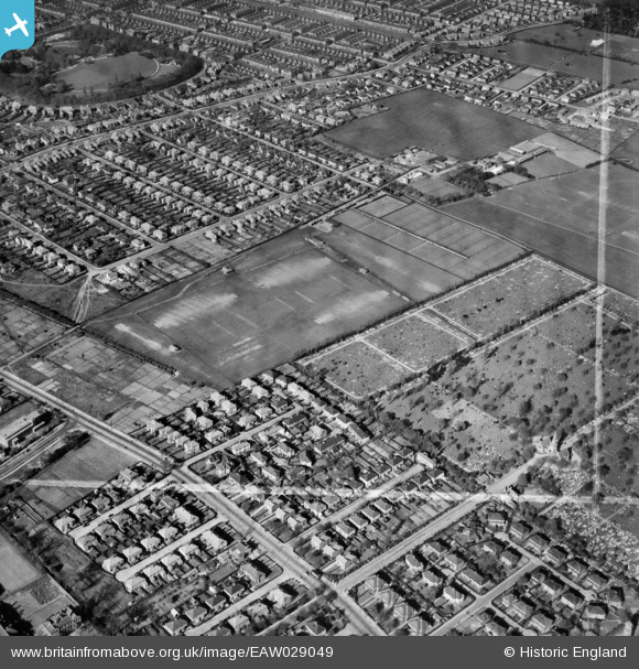
EAW029049 ENGLAND (1950). Barrett Recreation Ground and the Scartho Road Cemetery, Wellow, 1950. This image was marked by Aerofilms Ltd for photo editing.
© Copyright OpenStreetMap contributors and licensed by the OpenStreetMap Foundation. 2026. Cartography is licensed as CC BY-SA.
Nearby Images (6)
Details
| Title | [EAW029049] Barrett Recreation Ground and the Scartho Road Cemetery, Wellow, 1950. This image was marked by Aerofilms Ltd for photo editing. |
| Reference | EAW029049 |
| Date | 10-May-1950 |
| Link | |
| Place name | WELLOW |
| Parish | |
| District | |
| Country | ENGLAND |
| Easting / Northing | 526774, 407535 |
| Longitude / Latitude | -0.086320318347424, 53.548876414553 |
| National Grid Reference | TA268075 |


![[EAW029049] Barrett Recreation Ground and the Scartho Road Cemetery, Wellow, 1950. This image was marked by Aerofilms Ltd for photo editing.](http://britainfromabove.org.uk/sites/all/libraries/aerofilms-images/public/100x100/EAW/029/EAW029049.jpg)
![[EAW029053] Barrett Recreation Ground, Wellow, 1950](http://britainfromabove.org.uk/sites/all/libraries/aerofilms-images/public/100x100/EAW/029/EAW029053.jpg)
![[EAW029052] Barrett Recreation Ground and the Scartho Road Cemetery, Wellow, 1950. This image was marked by Aerofilms Ltd for photo editing.](http://britainfromabove.org.uk/sites/all/libraries/aerofilms-images/public/100x100/EAW/029/EAW029052.jpg)
![[EAW029051] Barrett Recreation Ground, Wellow, 1950. This image was marked by Aerofilms Ltd for photo editing.](http://britainfromabove.org.uk/sites/all/libraries/aerofilms-images/public/100x100/EAW/029/EAW029051.jpg)
![[EAW029050] Barrett Recreation Ground and the Scartho Road Cemetery, Wellow, 1950. This image was marked by Aerofilms Ltd for photo editing.](http://britainfromabove.org.uk/sites/all/libraries/aerofilms-images/public/100x100/EAW/029/EAW029050.jpg)
![[EAW029054] Barrett Recreation Ground, Wellow, 1950. This image was marked by Aerofilms Ltd for photo editing.](http://britainfromabove.org.uk/sites/all/libraries/aerofilms-images/public/100x100/EAW/029/EAW029054.jpg)
