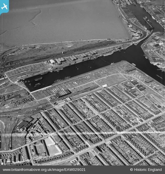
EAW029021 ENGLAND (1950). Alexandra Dock, Grimsby, 1950. This image was marked by Aerofilms Ltd for photo editing.
© Copyright OpenStreetMap contributors and licensed by the OpenStreetMap Foundation. 2026. Cartography is licensed as CC BY-SA.
Details
| Title | [EAW029021] Alexandra Dock, Grimsby, 1950. This image was marked by Aerofilms Ltd for photo editing. |
| Reference | EAW029021 |
| Date | 10-May-1950 |
| Link | |
| Place name | GRIMSBY |
| Parish | |
| District | |
| Country | ENGLAND |
| Easting / Northing | 526656, 410373 |
| Longitude / Latitude | -0.086949992629451, 53.574402499562 |
| National Grid Reference | TA267104 |
Pins

John Wass |
Sunday 2nd of November 2014 08:19:05 PM | |

Class31 |
Tuesday 4th of March 2014 06:53:27 PM | |

Class31 |
Monday 3rd of March 2014 05:57:12 PM |


![[EAW029021] Alexandra Dock, Grimsby, 1950. This image was marked by Aerofilms Ltd for photo editing.](http://britainfromabove.org.uk/sites/all/libraries/aerofilms-images/public/100x100/EAW/029/EAW029021.jpg)
![[EAW029022] Alexandra Dock, Grimsby, 1950. This image was marked by Aerofilms Ltd for photo editing.](http://britainfromabove.org.uk/sites/all/libraries/aerofilms-images/public/100x100/EAW/029/EAW029022.jpg)