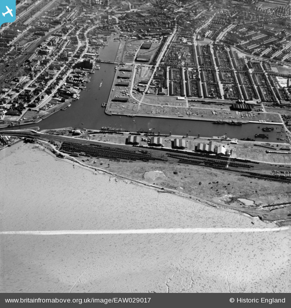
EAW029017 ENGLAND (1950). Alexandra Dock, Grimsby, 1950. This image was marked by Aerofilms Ltd for photo editing.
© Copyright OpenStreetMap contributors and licensed by the OpenStreetMap Foundation. 2026. Cartography is licensed as CC BY-SA.
Nearby Images (5)
Details
| Title | [EAW029017] Alexandra Dock, Grimsby, 1950. This image was marked by Aerofilms Ltd for photo editing. |
| Reference | EAW029017 |
| Date | 10-May-1950 |
| Link | |
| Place name | GRIMSBY |
| Parish | |
| District | |
| Country | ENGLAND |
| Easting / Northing | 526868, 410653 |
| Longitude / Latitude | -0.083636055630048, 53.57686687556 |
| National Grid Reference | TA269107 |
Pins

cptpies |
Tuesday 22nd of January 2019 08:07:31 AM | |

cptpies |
Tuesday 22nd of January 2019 08:06:58 AM | |

Class31 |
Tuesday 4th of March 2014 07:30:17 PM | |

Class31 |
Tuesday 4th of March 2014 07:29:13 PM | |

Class31 |
Tuesday 4th of March 2014 07:28:52 PM | |

Class31 |
Tuesday 4th of March 2014 07:28:29 PM |


![[EAW029017] Alexandra Dock, Grimsby, 1950. This image was marked by Aerofilms Ltd for photo editing.](http://britainfromabove.org.uk/sites/all/libraries/aerofilms-images/public/100x100/EAW/029/EAW029017.jpg)
![[EAW029019] Alexandra Dock, Grimsby, 1950. This image was marked by Aerofilms Ltd for photo editing.](http://britainfromabove.org.uk/sites/all/libraries/aerofilms-images/public/100x100/EAW/029/EAW029019.jpg)
![[EAW029020] Alexandra Dock, Grimsby, 1950. This image was marked by Aerofilms Ltd for photo editing.](http://britainfromabove.org.uk/sites/all/libraries/aerofilms-images/public/100x100/EAW/029/EAW029020.jpg)
![[EPW053388] Alexandra Dock, Grimsby, from the east, 1937](http://britainfromabove.org.uk/sites/all/libraries/aerofilms-images/public/100x100/EPW/053/EPW053388.jpg)
![[EAW418777] Dock, Grimsby, 1982](http://britainfromabove.org.uk/sites/all/libraries/aerofilms-images/public/100x100/EAW/418/EAW418777.jpg)