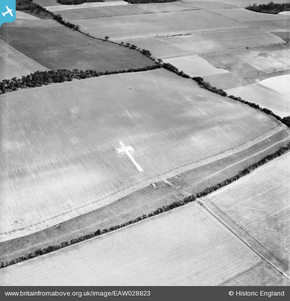
EAW028823 ENGLAND (1950). The Lenham Cross, Lenham, 1950
© Copyright OpenStreetMap contributors and licensed by the OpenStreetMap Foundation. 2025. Cartography is licensed as CC BY-SA.
Nearby Images (5)
Details
| Title | [EAW028823] The Lenham Cross, Lenham, 1950 |
| Reference | EAW028823 |
| Date | 1-May-1950 |
| Link | |
| Place name | LENHAM |
| Parish | LENHAM |
| District | |
| Country | ENGLAND |
| Easting / Northing | 590618, 152773 |
| Longitude / Latitude | 0.73123099480072, 51.241724646222 |
| National Grid Reference | TQ906528 |
Pins
Be the first to add a comment to this image!


![[EAW028823] The Lenham Cross, Lenham, 1950](http://britainfromabove.org.uk/sites/all/libraries/aerofilms-images/public/100x100/EAW/028/EAW028823.jpg)
![[EAW011821] The Lenham Cross, Lenham, 1947](http://britainfromabove.org.uk/sites/all/libraries/aerofilms-images/public/100x100/EAW/011/EAW011821.jpg)
![[EAW011822] The Lenham Cross, Lenham, 1947](http://britainfromabove.org.uk/sites/all/libraries/aerofilms-images/public/100x100/EAW/011/EAW011822.jpg)