
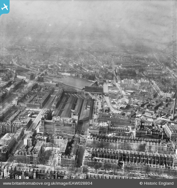
EAW028804 ENGLAND (1950). Paddington Railway Station and environs, Paddington, from the south-east, 1950
© Copyright OpenStreetMap contributors and licensed by the OpenStreetMap Foundation. 2026. Cartography is licensed as CC BY-SA.
Nearby Images (6)
EAW028804

EPW007994

EPW007995

EAW021739

EAW006462

EPW020961

Details
| Title | [EAW028804] Paddington Railway Station and environs, Paddington, from the south-east, 1950 |
| Reference | EAW028804 |
| Date | 25-April-1950 |
| Link | |
| Place name | PADDINGTON |
| Parish | |
| District | |
| Country | ENGLAND |
| Easting / Northing | 526732, 181260 |
| Longitude / Latitude | -0.17335932651365, 51.515547215357 |
| National Grid Reference | TQ267813 |
Pins


User Comment Contributions

Paddington Basin, 07/10/2014 |

Class31 |
Wednesday 8th of October 2014 04:35:05 PM |