
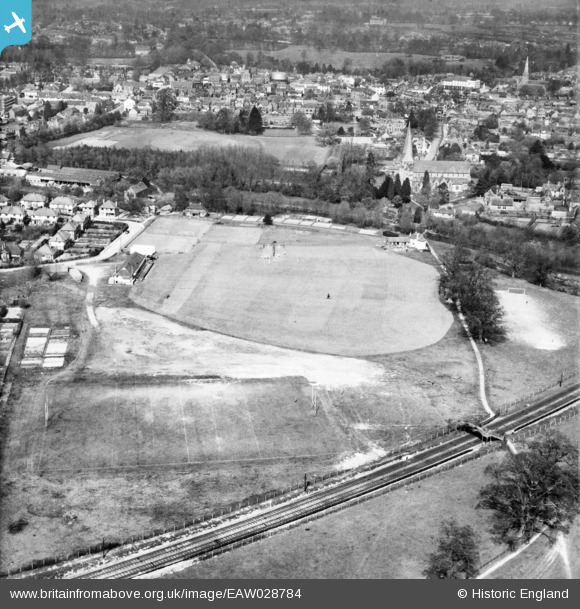
EAW028784 ENGLAND (1950). The Horsham Cricket Ground and St Mary's Church, Horsham, 1950
© Copyright OpenStreetMap contributors and licensed by the OpenStreetMap Foundation. 2026. Cartography is licensed as CC BY-SA.
Nearby Images (2)
EAW028784

EPW039505

Details
| Title | [EAW028784] The Horsham Cricket Ground and St Mary's Church, Horsham, 1950 |
| Reference | EAW028784 |
| Date | 25-April-1950 |
| Link | |
| Place name | HORSHAM |
| Parish | |
| District | |
| Country | ENGLAND |
| Easting / Northing | 516895, 130087 |
| Longitude / Latitude | -0.3318296382029, 51.057675750317 |
| National Grid Reference | TQ169301 |
Pins

Sparky |
Saturday 21st of October 2017 11:07:54 PM | |

Dan Gregory |
Monday 2nd of June 2014 11:41:36 PM | |
|
Dan Gregory |
Monday 2nd of June 2014 11:40:42 PM | |
now brewed under the Badger name however this Brewery was sold for redovelopment as Housing |
Elston |
Tuesday 3rd of June 2014 12:01:32 AM |
|
Dan Gregory |
Monday 2nd of June 2014 11:39:29 PM | |
|
Dan Gregory |
Monday 2nd of June 2014 11:37:19 PM | |
|
Dan Gregory |
Monday 2nd of June 2014 11:36:33 PM | |
|
Dan Gregory |
Monday 2nd of June 2014 11:35:42 PM | |
|
Dan Gregory |
Monday 2nd of June 2014 11:34:42 PM | |
|
Dan Gregory |
Monday 2nd of June 2014 11:33:37 PM | |
|
Dan Gregory |
Monday 2nd of June 2014 11:33:01 PM |