
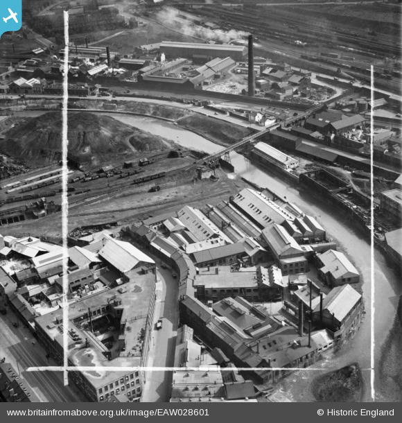
EAW028601 ENGLAND (1950). The Crescent and the Norfolk Bridge Steel Works alongside the Salmon Pastures Yard, Sheffield, 1950. This image was marked by Aerofilms Ltd for photo editing.
© Copyright OpenStreetMap contributors and licensed by the OpenStreetMap Foundation. 2026. Cartography is licensed as CC BY-SA.
Nearby Images (15)
EAW028601

EAW028602

EAW028603

EAW028605

EAW028607

EAW028606

EAW028604

EAW013688

EAW013687

EAW013691

EAW013690

EAW013692

EAW013686

EAW013689

EAW013685

Details
| Title | [EAW028601] The Crescent and the Norfolk Bridge Steel Works alongside the Salmon Pastures Yard, Sheffield, 1950. This image was marked by Aerofilms Ltd for photo editing. |
| Reference | EAW028601 |
| Date | 6-April-1950 |
| Link | |
| Place name | SHEFFIELD |
| Parish | |
| District | |
| Country | ENGLAND |
| Easting / Northing | 436967, 388152 |
| Longitude / Latitude | -1.4441008702346, 53.388649746214 |
| National Grid Reference | SK370882 |
Pins

Cheesy |
Saturday 1st of August 2015 09:48:51 PM |