
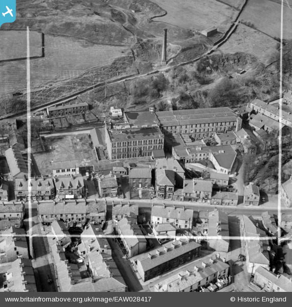
EAW028417 ENGLAND (1950). Britannia Cotton Mill and Burnley Road, Crawshawbooth, 1950. This image was marked by Aerofilms Ltd for photo editing.
© Copyright OpenStreetMap contributors and licensed by the OpenStreetMap Foundation. 2026. Cartography is licensed as CC BY-SA.
Nearby Images (8)
EAW028417

EAW028411

EAW028415

EAW028418

EAW028412

EAW028413

EAW028416

EAW028414

Details
| Title | [EAW028417] Britannia Cotton Mill and Burnley Road, Crawshawbooth, 1950. This image was marked by Aerofilms Ltd for photo editing. |
| Reference | EAW028417 |
| Date | 24-March-1950 |
| Link | |
| Place name | CRAWSHAWBOOTH |
| Parish | |
| District | |
| Country | ENGLAND |
| Easting / Northing | 381132, 425432 |
| Longitude / Latitude | -2.2859880425684, 53.724726466969 |
| National Grid Reference | SD811254 |
Pins
Be the first to add a comment to this image!