
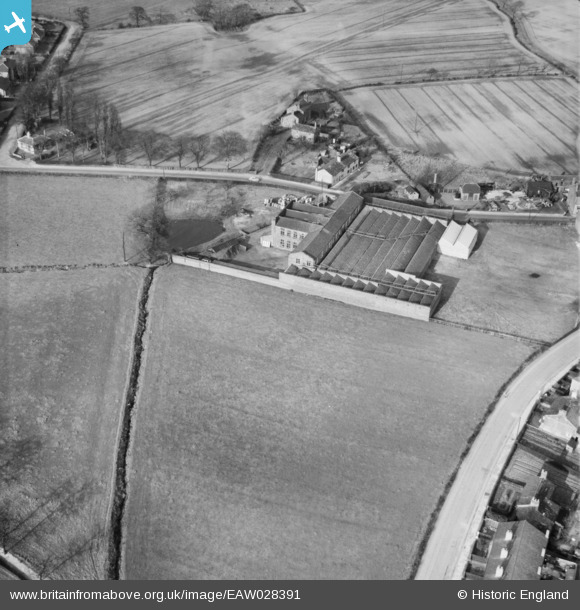
EAW028391 ENGLAND (1950). The Daisy Bank Cotton Mill, Culcheth, 1950
© Copyright OpenStreetMap contributors and licensed by the OpenStreetMap Foundation. 2026. Cartography is licensed as CC BY-SA.
Nearby Images (15)
EAW028391

EAW028390

EAW028386

EAW028385

EAW028389

EAW028387

EAW027360

EAW028393

EAW027359

EAW027357

EAW027361

EAW028392

EAW028388

EAW027356

EAW027358

Details
| Title | [EAW028391] The Daisy Bank Cotton Mill, Culcheth, 1950 |
| Reference | EAW028391 |
| Date | 25-March-1950 |
| Link | |
| Place name | CULCHETH |
| Parish | CULCHETH AND GLAZEBURY |
| District | |
| Country | ENGLAND |
| Easting / Northing | 365259, 395358 |
| Longitude / Latitude | -2.5232213925482, 53.453577115274 |
| National Grid Reference | SJ653954 |
Pins

Jeni |
Wednesday 10th of August 2016 12:46:41 PM | |
|
Dave |
Wednesday 26th of November 2014 12:11:53 PM | |
|
Jeni |
Friday 31st of October 2014 12:13:45 AM | |
|
Dave |
Monday 17th of February 2014 12:28:12 PM | |
You have this image marked as Hob Hey Lane but it is Twiss Green Lane. |
Jeni |
Tuesday 28th of October 2014 03:43:55 PM |
No it is not Hob Hey Lane - It is Twiss Green Lane |
Mortia |
Wednesday 18th of January 2017 10:17:29 AM |