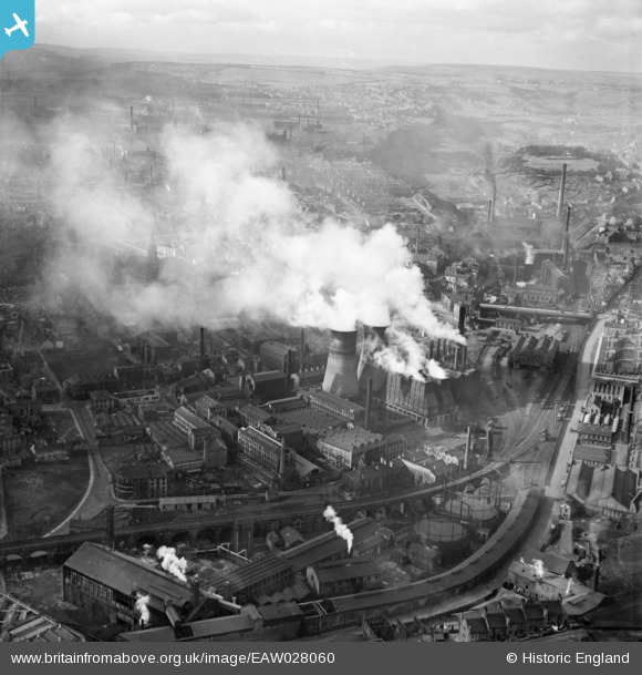
EAW028060 ENGLAND (1950). Halifax Power Station and surrounding mills, Halifax, from the east, 1950
© Copyright OpenStreetMap contributors and licensed by the OpenStreetMap Foundation. 2026. Cartography is licensed as CC BY-SA.
Nearby Images (9)
Details
| Title | [EAW028060] Halifax Power Station and surrounding mills, Halifax, from the east, 1950 |
| Reference | EAW028060 |
| Date | 21-February-1950 |
| Link | |
| Place name | HALIFAX |
| Parish | |
| District | |
| Country | ENGLAND |
| Easting / Northing | 409794, 425419 |
| Longitude / Latitude | -1.8515490168808, 53.724858911256 |
| National Grid Reference | SE098254 |
Pins

redmist |
Friday 1st of March 2019 11:00:05 AM |


![[EAW028060] Halifax Power Station and surrounding mills, Halifax, from the east, 1950](http://britainfromabove.org.uk/sites/all/libraries/aerofilms-images/public/100x100/EAW/028/EAW028060.jpg)
![[EAW028062] Halifax Power Station, Halifax, 1950](http://britainfromabove.org.uk/sites/all/libraries/aerofilms-images/public/100x100/EAW/028/EAW028062.jpg)
![[EAW028061] Halifax Power Station and North Bridge Goods Station, Halifax, 1950](http://britainfromabove.org.uk/sites/all/libraries/aerofilms-images/public/100x100/EAW/028/EAW028061.jpg)
![[EAW009198] The Caledonia Wire Mills and North Bridge Goods Station, Halifax, 1947. This image was marked by Aerofilms Ltd for photo editing.](http://britainfromabove.org.uk/sites/all/libraries/aerofilms-images/public/100x100/EAW/009/EAW009198.jpg)
![[EAW009199] The Caledonia Wire Mills, Halifax, 1947. This image was marked by Aerofilms Ltd for photo editing.](http://britainfromabove.org.uk/sites/all/libraries/aerofilms-images/public/100x100/EAW/009/EAW009199.jpg)
![[EAW009202] The Caledonia Wire Mills and environs, Halifax, 1947. This image was marked by Aerofilms Ltd for photo editing.](http://britainfromabove.org.uk/sites/all/libraries/aerofilms-images/public/100x100/EAW/009/EAW009202.jpg)
![[EAW009200] The Caledonia Wire Mills and environs, Halifax, 1947. This image was marked by Aerofilms Ltd for photo editing.](http://britainfromabove.org.uk/sites/all/libraries/aerofilms-images/public/100x100/EAW/009/EAW009200.jpg)
![[EAW009203] The Caledonia Wire Mills and environs, Halifax, 1947. This image was marked by Aerofilms Ltd for photo editing.](http://britainfromabove.org.uk/sites/all/libraries/aerofilms-images/public/100x100/EAW/009/EAW009203.jpg)
![[EAW009201] The Caledonia Wire Mills and North Bridge Goods Station, Halifax, 1947. This image was marked by Aerofilms Ltd for photo editing.](http://britainfromabove.org.uk/sites/all/libraries/aerofilms-images/public/100x100/EAW/009/EAW009201.jpg)