
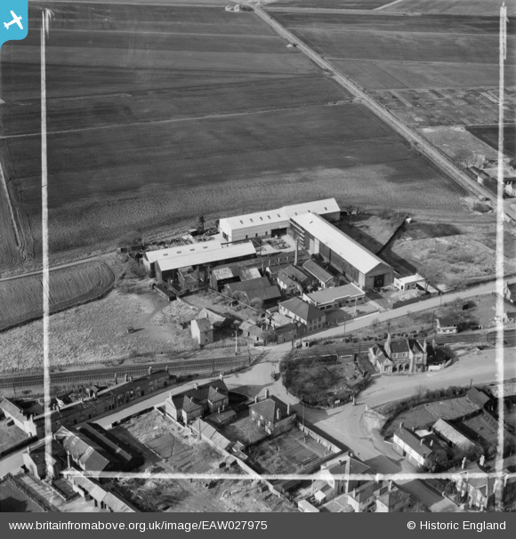
EAW027975 ENGLAND (1950). The Chatteris Engineering Works, Chatteris, 1950. This image was marked by Aerofilms Ltd for photo editing.
© Copyright OpenStreetMap contributors and licensed by the OpenStreetMap Foundation. 2026. Cartography is licensed as CC BY-SA.
Nearby Images (11)
EAW027975

EAW027978

EAW027974

EAW027977

EAW027981

EAW027982

EAW027979

EAW027976

EAW027973

EAW027980

EAW027972

Details
| Title | [EAW027975] The Chatteris Engineering Works, Chatteris, 1950. This image was marked by Aerofilms Ltd for photo editing. |
| Reference | EAW027975 |
| Date | 17-March-1950 |
| Link | |
| Place name | CHATTERIS |
| Parish | CHATTERIS |
| District | |
| Country | ENGLAND |
| Easting / Northing | 538639, 285985 |
| Longitude / Latitude | 0.040491015711304, 52.453827749054 |
| National Grid Reference | TL386860 |
Pins

H.E. |
Thursday 10th of February 2022 12:51:07 PM | |

Matt Aldred edob.mattaldred.com |
Friday 30th of August 2019 04:36:53 PM |