
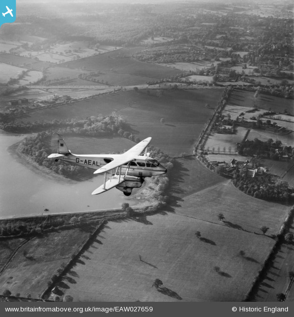
EAW027659 ENGLAND (1949). A Hunting Aerosurveys DH.89A Rapide (G-AEAL) in flight over Dagger Lane and Aldenham Reservoir, Aldenham, 1949
© Copyright OpenStreetMap contributors and licensed by the OpenStreetMap Foundation. 2026. Cartography is licensed as CC BY-SA.
Nearby Images (4)
EAW027659
 in flight over Dagger Lane and Aldenham Reservoir, Aldenham, 1949")
EAW023646

EPW053035

EAW016623

Details
| Title | [EAW027659] A Hunting Aerosurveys DH.89A Rapide (G-AEAL) in flight over Dagger Lane and Aldenham Reservoir, Aldenham, 1949 |
| Reference | EAW027659 |
| Date | 14-November-1949 |
| Link | |
| Place name | ALDENHAM |
| Parish | ALDENHAM |
| District | |
| Country | ENGLAND |
| Easting / Northing | 516567, 195611 |
| Longitude / Latitude | -0.31503555767722, 51.646730586678 |
| National Grid Reference | TQ166956 |
Pins
Be the first to add a comment to this image!