
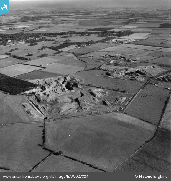
EAW027324 ENGLAND (1949). The Brenkley Opencast Coal Mining Site and Blagdon Park, Brenkley, from the south-west, 1949. This image has been produced from a print.
© Copyright OpenStreetMap contributors and licensed by the OpenStreetMap Foundation. 2026. Cartography is licensed as CC BY-SA.
Nearby Images (2)
EAW027324

EAW027323
, Brenkley, from the west, 1949. This image has been produced from a damaged negative.")
Details
| Title | [EAW027324] The Brenkley Opencast Coal Mining Site and Blagdon Park, Brenkley, from the south-west, 1949. This image has been produced from a print. |
| Reference | EAW027324 |
| Date | 21-October-1949 |
| Link | |
| Place name | BRENKLEY |
| Parish | DINNINGTON |
| District | |
| Country | ENGLAND |
| Easting / Northing | 420553, 575186 |
| Longitude / Latitude | -1.6781038932527, 55.07064857856 |
| National Grid Reference | NZ206752 |
Pins

TrevorM |
Thursday 26th of January 2023 03:02:29 PM | |
|
Darwinawardee |
Wednesday 6th of May 2020 08:36:26 AM | |
|
Darwinawardee |
Wednesday 6th of May 2020 08:02:53 AM | |
|
Darwinawardee |
Wednesday 6th of May 2020 07:57:22 AM | |
|
Darwinawardee |
Wednesday 6th of May 2020 07:54:01 AM | |
|
Darwinawardee |
Wednesday 6th of May 2020 07:51:14 AM | |
|
Darwinawardee |
Wednesday 6th of May 2020 07:49:10 AM | |
|
Darwinawardee |
Wednesday 6th of May 2020 07:47:14 AM | |
|
Darwinawardee |
Wednesday 6th of May 2020 07:46:28 AM |