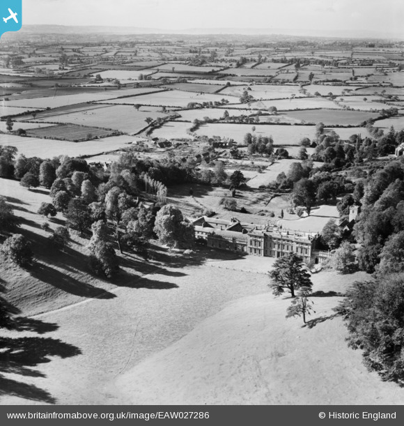
EAW027286 ENGLAND (1949). Dyrham House and Park, Dyrham, from the north-east, 1949
© Copyright OpenStreetMap contributors and licensed by the OpenStreetMap Foundation. 2024. Cartography is licensed as CC BY-SA.
Nearby Images (6)
Details
| Title | [EAW027286] Dyrham House and Park, Dyrham, from the north-east, 1949 |
| Reference | EAW027286 |
| Date | 19-October-1949 |
| Link | |
| Place name | DYRHAM |
| Parish | DYRHAM AND HINTON |
| District | |
| Country | ENGLAND |
| Easting / Northing | 374253, 175740 |
| Longitude / Latitude | -2.3707963619574, 51.479544748742 |
| National Grid Reference | ST743757 |
Pins
 mike.f |
Wednesday 30th of April 2014 09:01:15 PM |


![[EAW027286] Dyrham House and Park, Dyrham, from the north-east, 1949](http://britainfromabove.org.uk/sites/all/libraries/aerofilms-images/public/100x100/EAW/027/EAW027286.jpg)
![[EAW027284] Dyrham House and Park, Dyrham, 1949. This image has been produced from a print marked by Aerofilms Ltd for photo editing.](http://britainfromabove.org.uk/sites/all/libraries/aerofilms-images/public/100x100/EAW/027/EAW027284.jpg)
![[EAW027287] Dyrham House and Park, Dyrham, 1949. This image was marked by Aerofilms Ltd for photo editing.](http://britainfromabove.org.uk/sites/all/libraries/aerofilms-images/public/100x100/EAW/027/EAW027287.jpg)
![[EAW027282] Dyrham House and Park, Dyrham, 1949. This image has been produced from a print marked by Aerofilms Ltd for photo editing.](http://britainfromabove.org.uk/sites/all/libraries/aerofilms-images/public/100x100/EAW/027/EAW027282.jpg)
![[EAW027283] Dyrham House and Park, Dyrham, 1949. This image has been produced from a print.](http://britainfromabove.org.uk/sites/all/libraries/aerofilms-images/public/100x100/EAW/027/EAW027283.jpg)
![[EAW027285] Dyrham House and Park, Dyrham, 1949. This image was marked by Aerofilms Ltd for photo editing.](http://britainfromabove.org.uk/sites/all/libraries/aerofilms-images/public/100x100/EAW/027/EAW027285.jpg)
