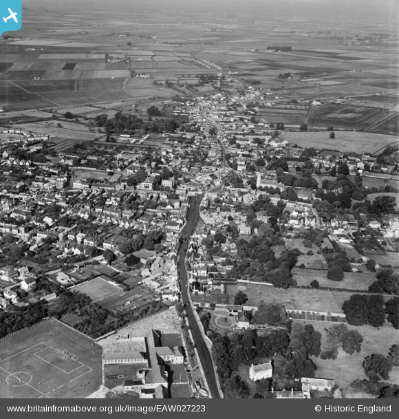
EAW027223 ENGLAND (1949). The town centre, Chatteris, 1949
© Copyright OpenStreetMap contributors and licensed by the OpenStreetMap Foundation. 2026. Cartography is licensed as CC BY-SA.
Details
| Title | [EAW027223] The town centre, Chatteris, 1949 |
| Reference | EAW027223 |
| Date | 12-October-1949 |
| Link | |
| Place name | CHATTERIS |
| Parish | CHATTERIS |
| District | |
| Country | ENGLAND |
| Easting / Northing | 539457, 285871 |
| Longitude / Latitude | 0.052474344377908, 52.452595190051 |
| National Grid Reference | TL395859 |
Pins

H.E. |
Monday 7th of November 2022 04:44:36 PM | |

H.E. |
Monday 7th of November 2022 04:43:47 PM | |

H.E. |
Thursday 10th of February 2022 12:42:17 PM | |

H.E. |
Thursday 10th of February 2022 12:36:04 PM | |

H.E. |
Thursday 10th of February 2022 12:32:10 PM | |

H.E. |
Thursday 10th of February 2022 12:19:59 PM | |

H.E. |
Thursday 10th of February 2022 12:18:40 PM | |

H.E. |
Thursday 10th of February 2022 12:17:52 PM |


![[EAW027223] The town centre, Chatteris, 1949](http://britainfromabove.org.uk/sites/all/libraries/aerofilms-images/public/100x100/EAW/027/EAW027223.jpg)
![[EAW027219] The town centre, Chatteris, 1949](http://britainfromabove.org.uk/sites/all/libraries/aerofilms-images/public/100x100/EAW/027/EAW027219.jpg)
![[EAW027221] The town centre, Chatteris, 1949](http://britainfromabove.org.uk/sites/all/libraries/aerofilms-images/public/100x100/EAW/027/EAW027221.jpg)
![[EAW031910] The town, Chatteris, 1950](http://britainfromabove.org.uk/sites/all/libraries/aerofilms-images/public/100x100/EAW/031/EAW031910.jpg)