
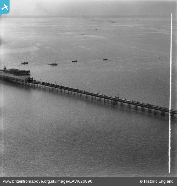
EAW026890 ENGLAND (1949). Southend Pier, Southend-on-Sea, from the north-east, 1949. This image has been produced from a print marked by Aerofilms Ltd for photo editing.
© Copyright OpenStreetMap contributors and licensed by the OpenStreetMap Foundation. 2026. Cartography is licensed as CC BY-SA.
Nearby Images (20)
EAW026890

EAW042704

EAW002210

EAW026898

EAW026893

EAW026895

EAW002209

EAW002212

EAW038549

EAW002211

EAW002213

EAW026896

EAW026892

EPW036623

EPW000561

EAW026894

EAW002214

EAW042705

EPW000445

EAW054228

Details
| Title | [EAW026890] Southend Pier, Southend-on-Sea, from the north-east, 1949. This image has been produced from a print marked by Aerofilms Ltd for photo editing. |
| Reference | EAW026890 |
| Date | 2-October-1949 |
| Link | |
| Place name | SOUTHEND-ON-SEA |
| Parish | |
| District | |
| Country | ENGLAND |
| Easting / Northing | 588943, 183375 |
| Longitude / Latitude | 0.72353713607162, 51.517166963848 |
| National Grid Reference | TQ889834 |
Pins
Be the first to add a comment to this image!