
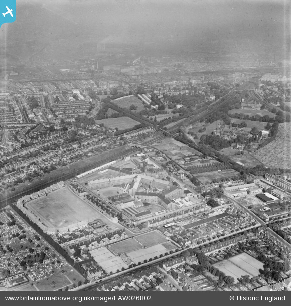
EAW026802 ENGLAND (1949). HM Prison Wandsworth, Wandsworth, from the south, 1949
© Copyright OpenStreetMap contributors and licensed by the OpenStreetMap Foundation. 2026. Cartography is licensed as CC BY-SA.
Nearby Images (2)
EAW026802

EAW015856
 and Wandsworth (Earlsfield) Cemetery, Earlsfield, 1948. This image has been produced from a damaged negative.")
Details
| Title | [EAW026802] HM Prison Wandsworth, Wandsworth, from the south, 1949 |
| Reference | EAW026802 |
| Date | 3-October-1949 |
| Link | |
| Place name | WANDSWORTH |
| Parish | |
| District | |
| Country | ENGLAND |
| Easting / Northing | 526755, 173754 |
| Longitude / Latitude | -0.17572256361601, 51.448078382135 |
| National Grid Reference | TQ268738 |
Pins

Richard |
Tuesday 26th of July 2022 05:53:49 PM | |
|
Hon Sec |
Saturday 25th of February 2017 05:01:33 PM | |
|
Hon Sec |
Saturday 25th of February 2017 04:59:18 PM | |
|
Hon Sec |
Saturday 25th of February 2017 04:58:13 PM | |
|
Hon Sec |
Saturday 25th of February 2017 04:57:25 PM | |
|
Hon Sec |
Saturday 25th of February 2017 04:55:55 PM | |
|
Hon Sec |
Saturday 25th of February 2017 04:55:35 PM |