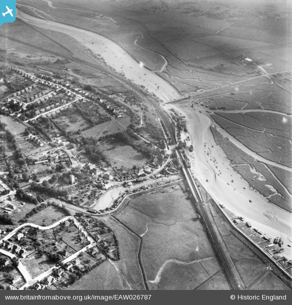
EAW026787 ENGLAND (1949). The High Street and Benfleet Railway Station alongside Benfleet Creek, South Benfleet, 1949
    © Copyright OpenStreetMap contributors and licensed by the OpenStreetMap Foundation. 2025. Cartography is licensed as CC BY-SA.
  
Nearby Images (6)
Details
| Title | [EAW026787] The High Street and Benfleet Railway Station alongside Benfleet Creek, South Benfleet, 1949 | 
| Reference | EAW026787 | 
| Date | 3-October-1949 | 
| Link | |
| Place name | SOUTH BENFLEET | 
| Parish | |
| District | |
| Country | ENGLAND | 
| Easting / Northing | 577833, 185915 | 
| Longitude / Latitude | 0.56485160924073, 51.543592063091 | 
| National Grid Reference | TQ778859 | 
Pins
Be the first to add a comment to this image!
 
             
  ![[EAW026787] The High Street and Benfleet Railway Station alongside Benfleet Creek, South Benfleet, 1949](http://britainfromabove.org.uk/sites/all/libraries/aerofilms-images/public/100x100/EAW/026/EAW026787.jpg) 
  
                                          ![[EAW026790] Benfleet Railway Station and the town centre, South Benfleet, 1949](http://britainfromabove.org.uk/sites/all/libraries/aerofilms-images/public/100x100/EAW/026/EAW026790.jpg) 
 ![[EAW026792] Benfleet Railway Station and environs, South Benfleet, 1949. This image has been produced from a print.](http://britainfromabove.org.uk/sites/all/libraries/aerofilms-images/public/100x100/EAW/026/EAW026792.jpg) 
 ![[EAW026789] Benfleet Creek and the town, South Benfleet, 1949](http://britainfromabove.org.uk/sites/all/libraries/aerofilms-images/public/100x100/EAW/026/EAW026789.jpg) 
 ![[EAW026791] Benfleet Creek, Benfleet Railway Station and the town, South Benfleet, 1949. This image has been produced from a print.](http://britainfromabove.org.uk/sites/all/libraries/aerofilms-images/public/100x100/EAW/026/EAW026791.jpg) 
 ![[EAW026788] Benfleet Creek and the town, South Benfleet, 1949](http://britainfromabove.org.uk/sites/all/libraries/aerofilms-images/public/100x100/EAW/026/EAW026788.jpg)