
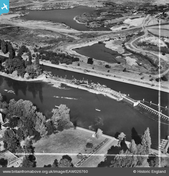
EAW026760 ENGLAND (1949). Teddington Weir under construction, Teddington, 1949. This image was marked by Aerofilms Ltd for photo editing.
© Copyright OpenStreetMap contributors and licensed by the OpenStreetMap Foundation. 2026. Cartography is licensed as CC BY-SA.
Nearby Images (23)
EAW026760

EAW026764

EAW026761

EAW026762

EAW026763

EPW023406

EPR000639

EAW026765

EAW007446

EPW023410

EPW023393

EAW042760

EAW042761

EAW008258

EPW023394

EAW007427

EAW007438

EAW007437

EAW007428

EAW007432

EAW007434

EAW007439

EAW007445

Details
| Title | [EAW026760] Teddington Weir under construction, Teddington, 1949. This image was marked by Aerofilms Ltd for photo editing. |
| Reference | EAW026760 |
| Date | 3-October-1949 |
| Link | |
| Place name | TEDDINGTON |
| Parish | |
| District | |
| Country | ENGLAND |
| Easting / Northing | 516904, 171467 |
| Longitude / Latitude | -0.31818657116328, 51.429641000025 |
| National Grid Reference | TQ169715 |
Pins
Be the first to add a comment to this image!