
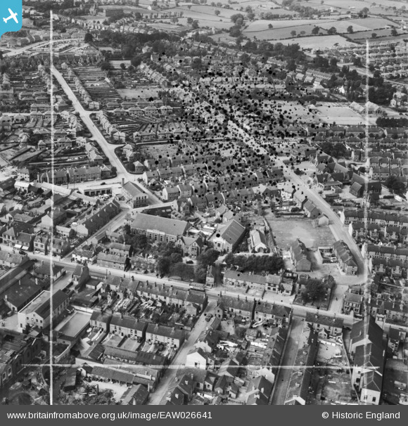
EAW026641 ENGLAND (1949). Chatsworth Road, School Board Lane, Springfield Avenue and environs, Chesterfield, 1949. This image has been produced from a damaged negative.
© Copyright OpenStreetMap contributors and licensed by the OpenStreetMap Foundation. 2026. Cartography is licensed as CC BY-SA.
Nearby Images (2)
EAW026641

EAW026640

Details
| Title | [EAW026641] Chatsworth Road, School Board Lane, Springfield Avenue and environs, Chesterfield, 1949. This image has been produced from a damaged negative. |
| Reference | EAW026641 |
| Date | 19-September-1949 |
| Link | |
| Place name | CHESTERFIELD |
| Parish | |
| District | |
| Country | ENGLAND |
| Easting / Northing | 437168, 371060 |
| Longitude / Latitude | -1.4430817841813, 53.234990193706 |
| National Grid Reference | SK372711 |
Pins

dd1000 |
Wednesday 18th of September 2019 09:32:12 PM | |
 |
dd1000 |
Wednesday 18th of September 2019 09:30:36 PM |
|
dd1000 |
Friday 19th of July 2019 11:42:22 AM | |
|
dd1000 |
Friday 19th of July 2019 11:41:46 AM | |
|
dd1000 |
Friday 19th of July 2019 11:41:01 AM | |
|
dd1000 |
Friday 19th of July 2019 11:40:21 AM |